Point Cloud to Allplan – Erich-Kästner School Füssen: Case Study

87629 Füssen, Bavaria
.prj · IFC2x3 · QC Report
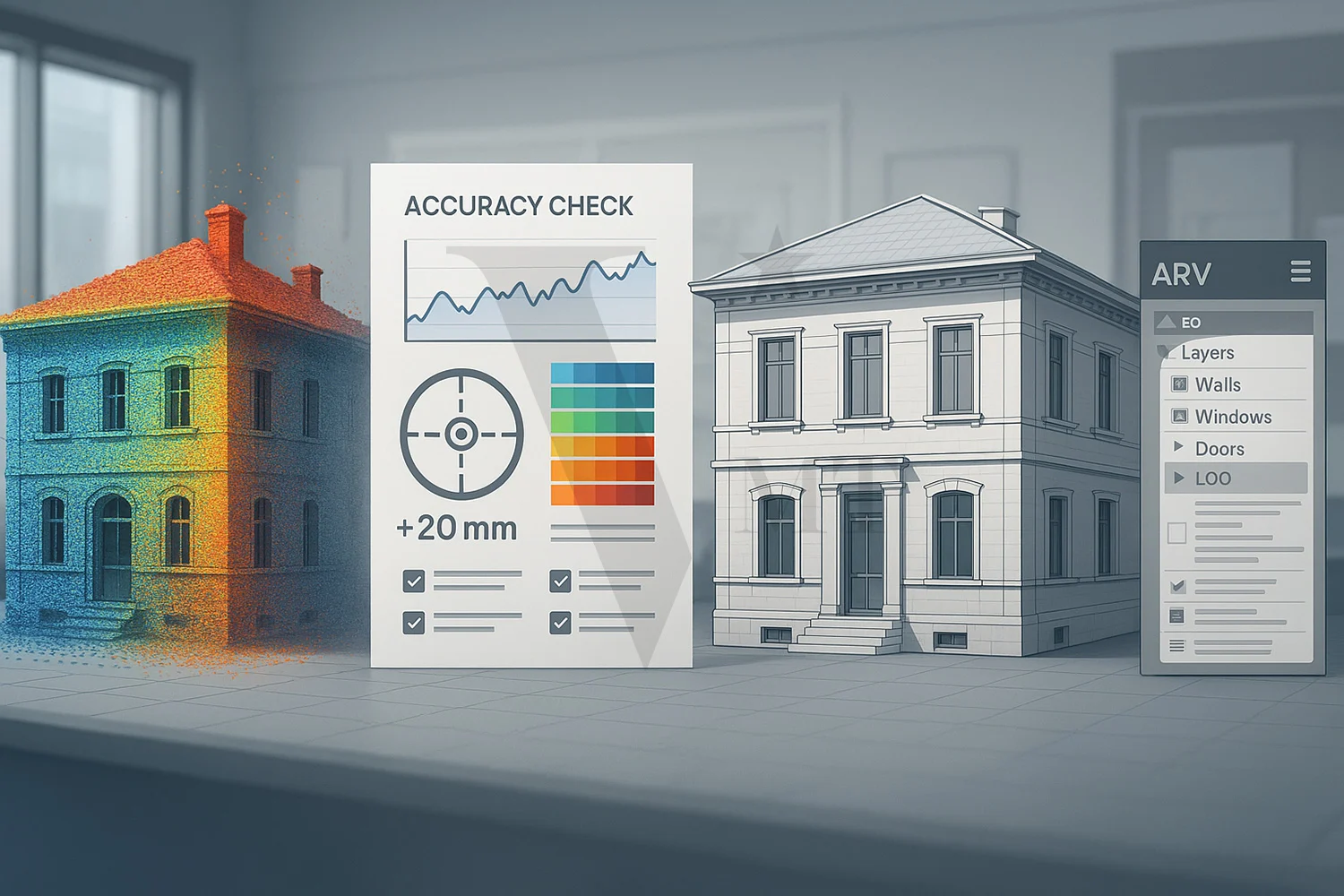
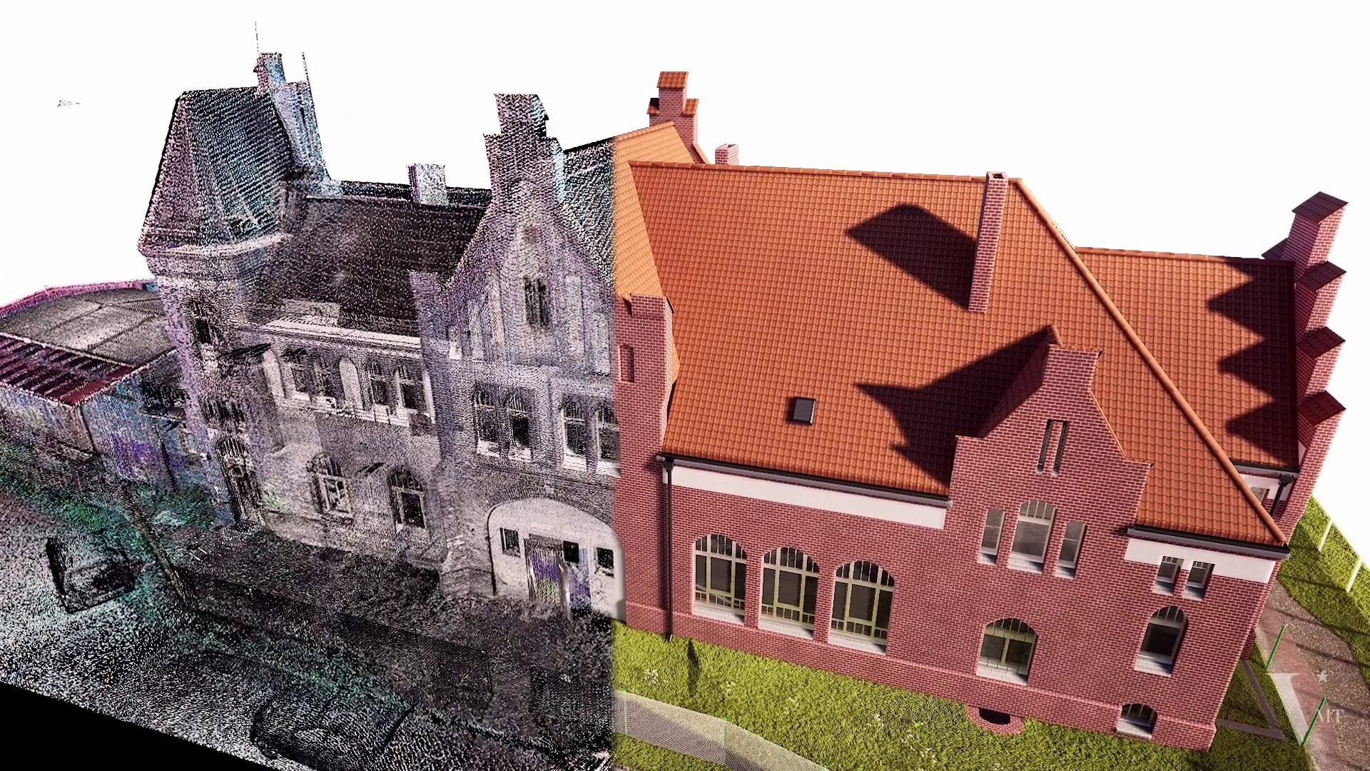
Point Cloud to Allplan refers to the process of converting 3D laser scan data (point clouds) into a native BIM model in Allplan software. The result is a fully editable .prj project file with parametric Allplan components, attributes, and a georeferenced project structure – ready to use for as-built documentation, renovation planning, and public tenders.
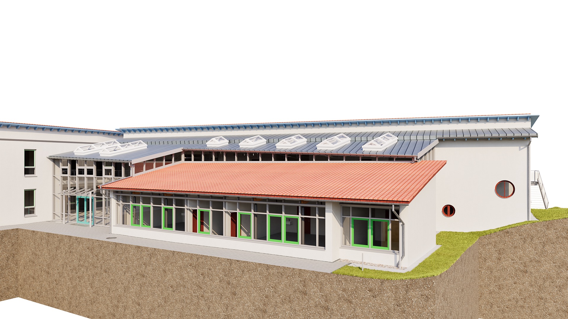
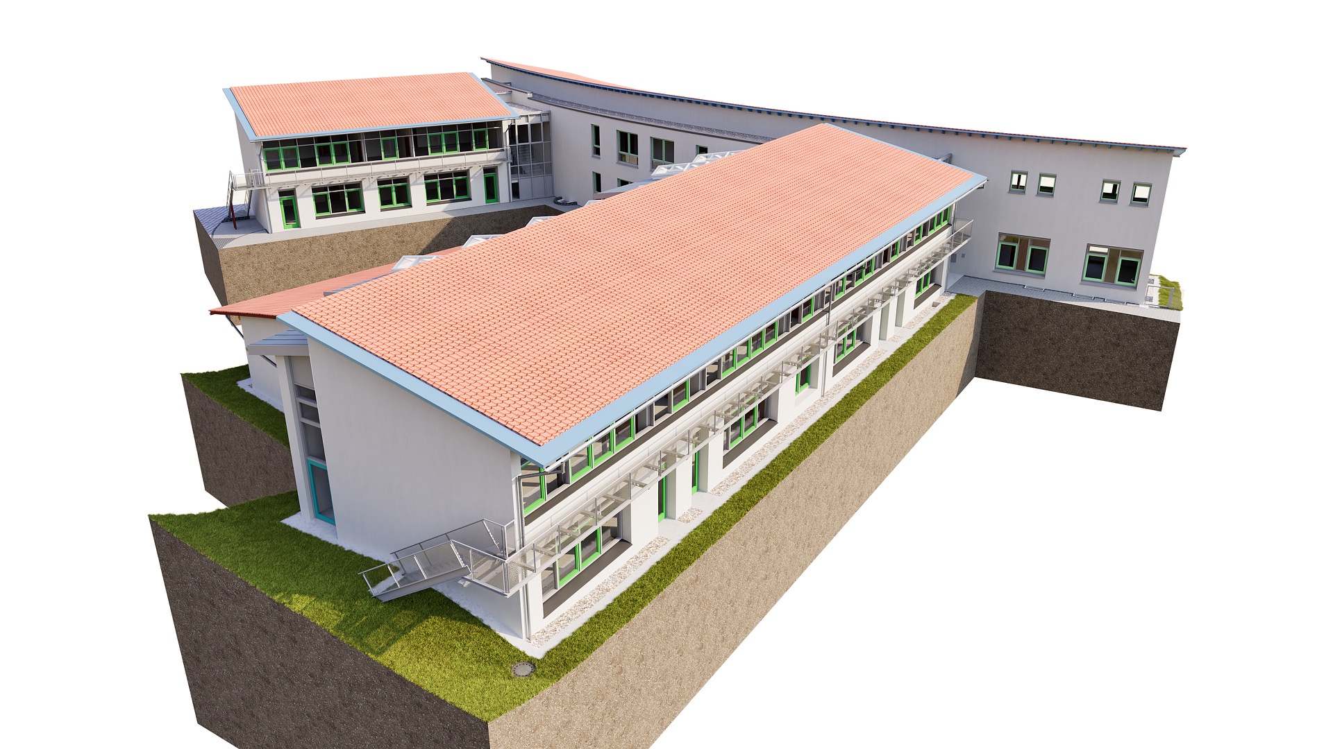
Erich-Kästner School in Füssen – a Special Needs Support Center operated by the Ostallgäu District Office – was approaching a renovation project. The point cloud was already in place. What was missing was a fully editable, native Allplan BIM model. VMT Solutions took on this step: from quality verification of the scan data to on-schedule model delivery in 12 working days.
The Starting Situation
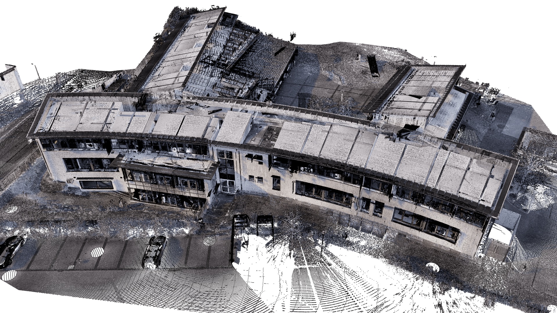
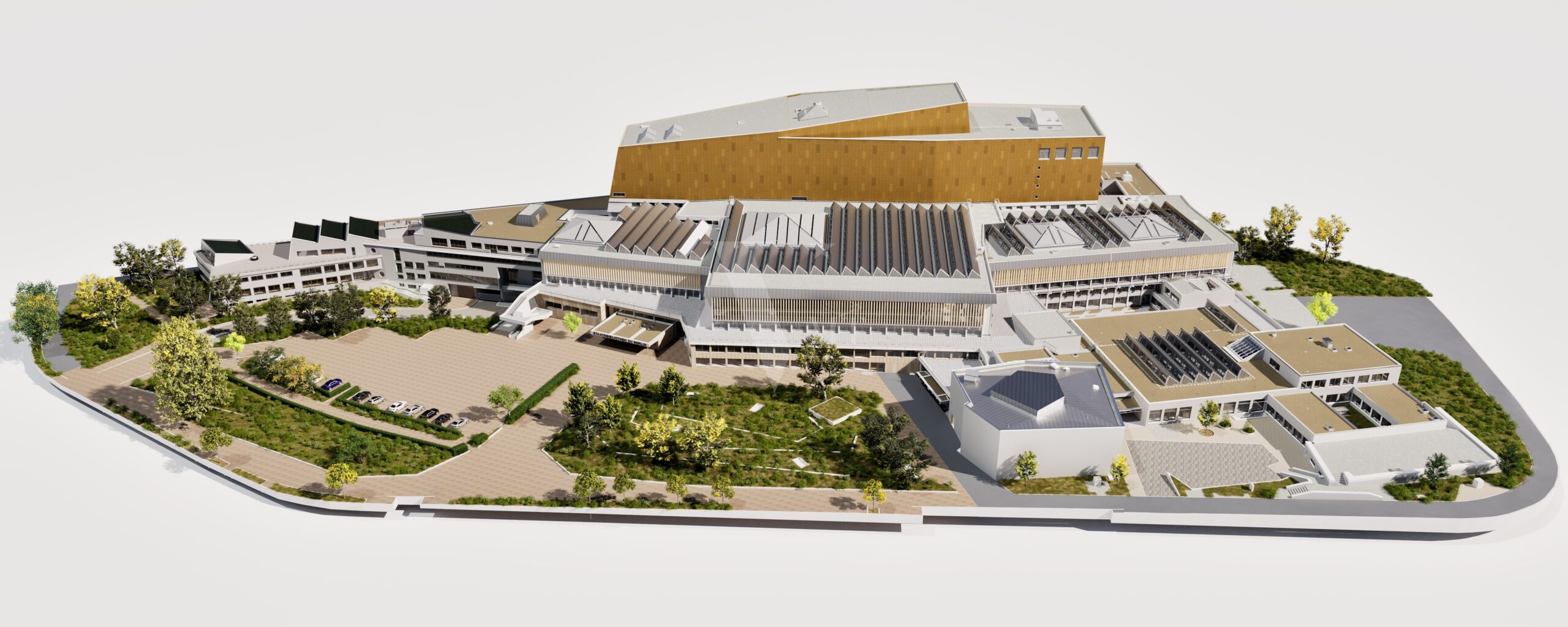
The commissioning surveying office had already fully captured Erich-Kästner School at Feistlestraße 3 in Füssen using a 3D laser scanner. The building, a Special Needs Support Center under the authority of the Ostallgäu District Office, was documented for an upcoming renovation – precise scan data was fully available.
The challenge lay not in data quality but in capacity: the internal BIM modeling capacity at the surveying office was fully occupied with parallel projects. Without external support, delivery to the client would have been delayed. The building itself presented typical requirements of a layered public building stock:
- Multiple building sections from different construction phases with varying floor heights
- Complex roof geometries over the main building and extensions
- Stair cores and connecting corridors with limited line of sight
- Exterior areas with access surfaces, ramps, and terrain model
What Does “Native Allplan Modeling” Mean?
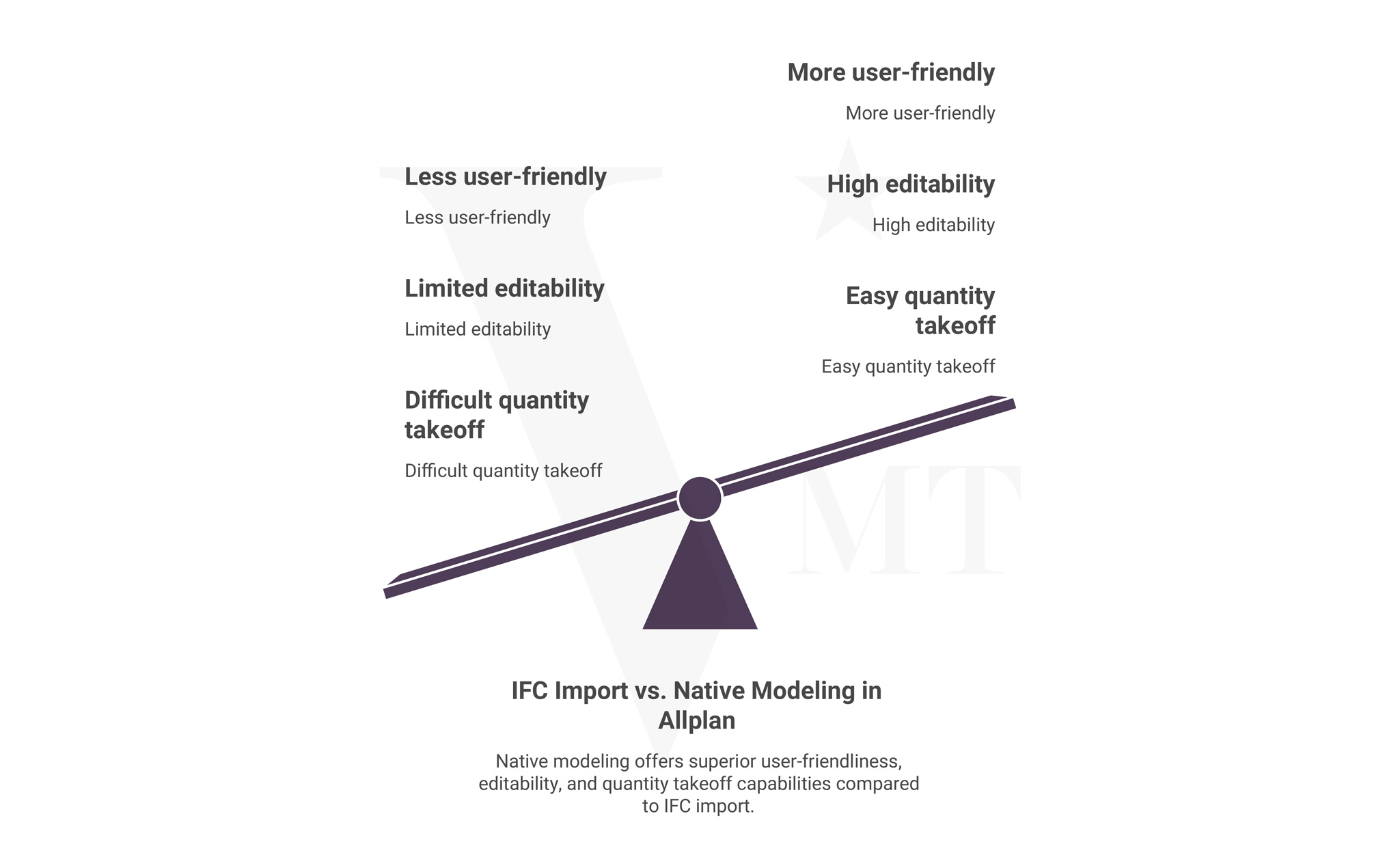
The distinction is critical for the project because it marks a significant practical difference.
IFC Import
Model from another platform
A model is created in Revit or Archicad and exported as IFC. Allplan can open the file, but components are not parametric and attributes are not correctly linked.
- No editable Allplan objects
- Significant rework required
- Incompatible attribute structure
- No Allplan project standard
Native in Allplan
Directly usable .prj project file
The model is built from the start in Allplan – with Allplan components, attributes, and the client’s project-specific folder structure.
- Fully editable Allplan objects
- No conversion effort
- Attribute structure per office standard
- Seamless integration into existing workflows
For the Ostallgäu District Office, which uses Allplan as its planning standard, a native Allplan model was not optional – it was a prerequisite for design phases 3 to 5, tender documents, and coordination with contractors.
The Workflow Step by Step
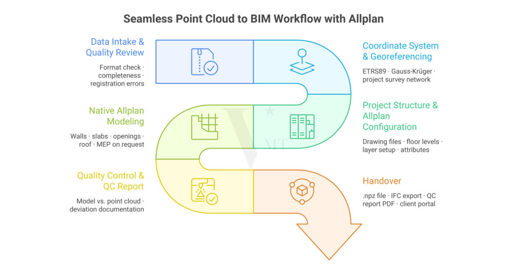
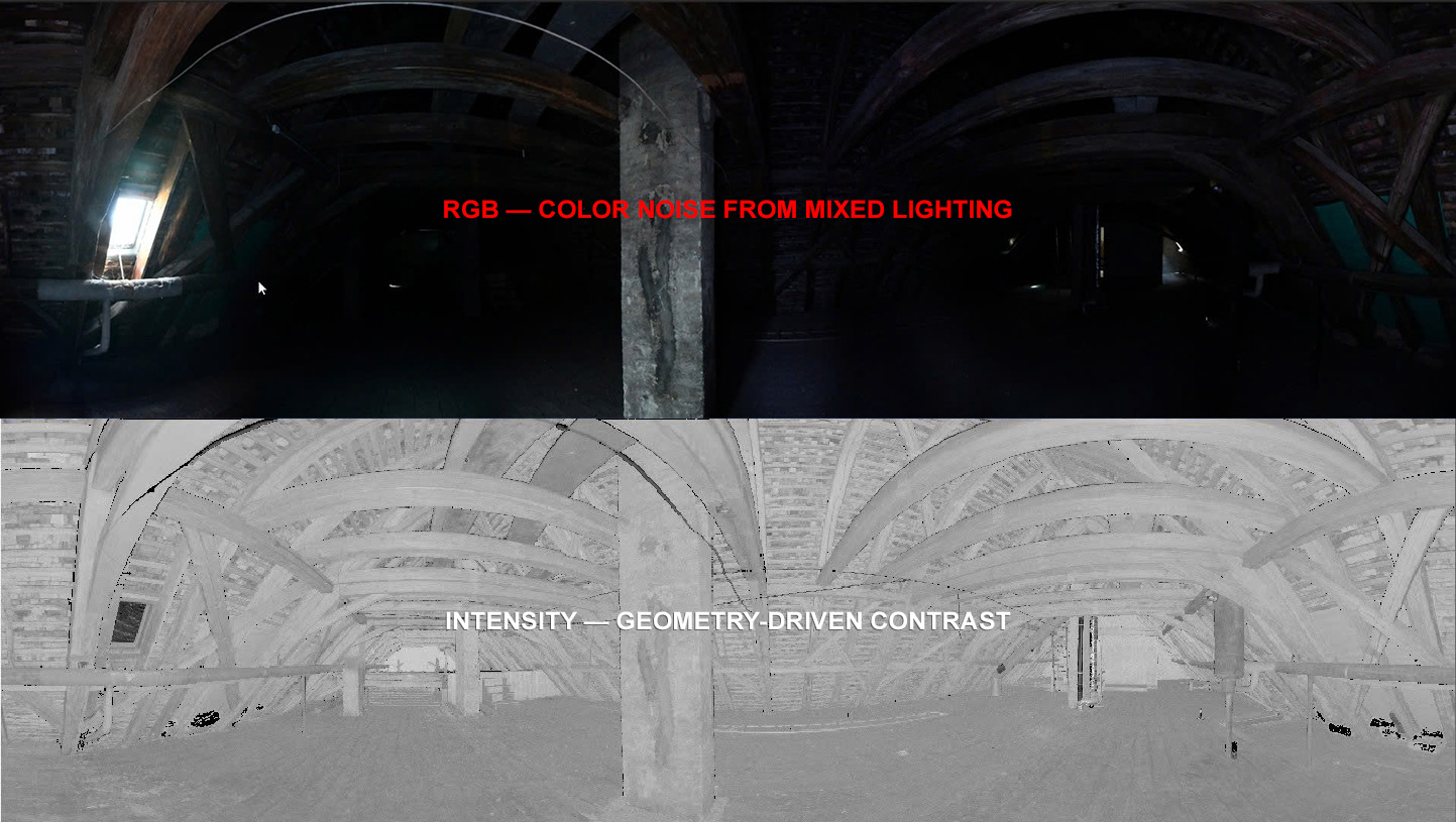
The delivered point cloud (format: E57) was thoroughly reviewed before modeling began – not only for format, but for complete coverage of all building areas.
- Completeness of all floors in main and auxiliary buildings
- Registration quality between individual scans (tolerance < 5 mm)
- Critical areas: stair cores, connecting corridors, roof structures
- Point density relative to the agreed LOD 300
The point cloud carried the surveying office’s coordinate system (ETRS89). This system was transferred directly into the Allplan project. The BIM model is therefore accurately positioned in both plan and elevation – relevant for subsequent combination with site plan documents and geodata from the District Office.
Before modeling, the project structure was set up in Allplan: partial drawings per floor and building section, layer structure per office standard, attribute assignments for room designations and component properties. The configuration followed the requirements of the commissioning office.
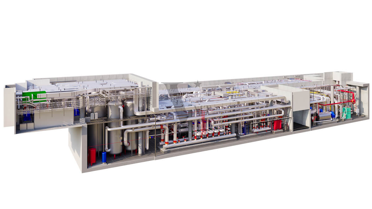
Modeling was carried out in Allplan with direct reference to the point cloud. The following components were captured within the LOD 300 scope:
- Structure and architecture: External and internal walls, columns, slabs, roof structure (selected areas LOD 350), window and door openings with reveal details, stairs, ramps, parapets
- Exterior areas: Terrain model from point cloud data, access surfaces, ramps, exterior stairs
Every component is based exclusively on measurable geometries from the point cloud – no interpolated or assumed dimensions.
After modeling was complete, the Allplan model was systematically checked back against the point cloud. A QC report (PDF) documents:
- Dimensional accuracy (target value ± 15 mm for LOD 300, achieved)
- Areas with point cloud gaps and assumptions made
- Notes on special areas of the roof geometry (LOD 350)
Deliverables after 12 working days:
- Allplan project file (.prj) in the version used by the client
- IFC export (IFC2x3) for interdisciplinary exchange
- QC report as PDF
- Brief documentation of the project structure
LOD Levels: What Was Realistic in This Project?
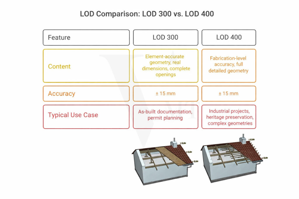
| LOD | Content | Typical Use Case | In This Project |
|---|---|---|---|
| LOD 200 | Mass components, no exact dimensions | Early phase, cost estimation | Not required |
| LOD 300 | Component-accurate geometry, real dimensions, complete openings | Design and approval planning, as-built documentation | Project standard |
| LOD 350 | As LOD 300, plus connection details | Coordination model, interdisciplinary planning | Roof geometry (selected) |
| LOD 400 | Fabrication-level accuracy | Heritage preservation, industrial projects | Not included |
For public school buildings and renovation projects, LOD 300 is the practical standard. It covers design phases 3 to 5 and delivers the accuracy required for tender documents and planning coordination. The roof areas of Erich-Kästner School were partially executed at LOD 350 due to their structural complexity.
Challenges in the Project
Multi-Phase Building Stock
Main building and extensions originate from different construction phases. Floor heights vary, and transition areas are not structurally uniform. Each connection point was individually analyzed and documented on the basis of the point cloud.
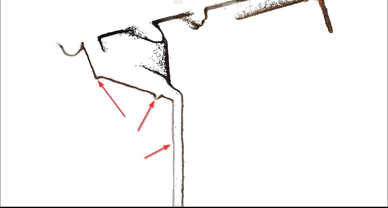
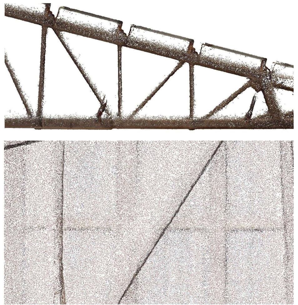
Roof Structure with Deformations
Historic roof elements show settlement and deformation. The geometry was modeled on the basis of actual scan data – without geometric simplifications. Deviations are documented in the QC report.
Point Cloud Gaps in Technical Areas
A utility shaft and a basement section were not fully captured in the point cloud. In these areas, plausible geometric assumptions were made and transparently noted in the QC report.
Version Compatibility
Allplan projects are version-specific. The model was delivered in the Allplan version used by the commissioning office. The version number was agreed at the time of order placement.
Result: A Directly Usable Allplan Model
The surveying office received, after 12 working days, a complete native Allplan model of Erich-Kästner School Füssen that integrated into the Ostallgäu District Office’s planning workflow without any conversion or adaptation effort. A comparable scope was delivered for the State Library Berlin – 170,000 m² as-built survey, native at LOD 300.
VMT Solutions
You scan – we support all downstream services, from point clouds to native BIM models.
Frequently Asked Questions
A native Allplan model is built directly in Allplan using Allplan components, attributes, and a project-specific folder structure. It is fully editable and integrates into existing Allplan workflows without any additional effort. An IFC import contains geometry but no parametric Allplan objects – every modification requires significant rework and the attribute structure is not compatible.
We work with all common formats: E57, RCP, LAS, FLS, LAZ, XYZ, and PTX. For proprietary formats, we recommend a pre-conversion by the surveying office.
For as-built survey and renovation planning, LOD 300 is the practical standard. It covers design phases 3 to 5 and delivers component-accurate geometry, real dimensions, and complete openings. Selected areas can be extended to LOD 350 or LOD 400, depending on point cloud quality.
This depends on size, complexity, and agreed LOD. The model of Erich-Kästner School Füssen was delivered in 12 working days. For new projects, we agree on a binding schedule after reviewing the point cloud.
Delivery includes as standard the Allplan project file (.prj) in the version used by the client, an IFC export (IFC2x3) on request, and a QC report as PDF with dimensional accuracy verification. Data is delivered via the VMT Solutions client portal, WeTransfer, or a secure file transfer channel.
Scan to BIM for public buildings refers to the process of capturing an existing building with a 3D laser scanner and converting the point cloud data into a native BIM model. For municipal properties, schools, and administrative buildings in Bavaria and Germany, Allplan is frequently used as the BIM platform, as many public-sector clients use Allplan as their planning standard. VMT Solutions delivers these models at LOD 300 – ready for design phases 3 to 5, tender documents, and coordination with contractors.
Work with VMT Solutions
Do you have a point cloud for your next project?
Describe your project briefly using our online form. We will respond within one business day with an initial assessment – on schedule, transparent, and without any pre-commitment.
Nguyen Huynh (Rainer)
")
About the Author:
Nguyen Huynh (Rainer) is Managing Director at VMT Solutions, specializing in Point Cloud to BIM workflows for surveying, planning, and engineering offices. He focuses on precise BIM models, clearly defined quality standards, and long-term technical partnerships.
Share This Story!
Recent Posts

We are proud to have
satisfied customers.
 Gerd Gindullis, Lecturer for digital as-built data capture at Aachen University of Applied Sciences, TerraMeta 3D Laser Service
 Stefan Schramm, Architekt Stefan Schramm
„Your plans are perfect; I’ve never seen anything like this before. These are drawings of the highest quality, I must say. I want to express my sincere thanks once again for your work.“
 Endre Szokolai, Digitalplan-Szokolai
VMT modeled a large industrial building in 3D for our research project. We provided DWG plans to VMT, and they delivered a highly detailed model, including the building envelope, interior walls, openings, and stairs. We had previously contracted a German company for the same object, but unfortunately, it didn’t work out. I was relieved and pleased that VMT handled it so reliably. Thank you for the excellent work and the truly fair price!

Very reliable company, courteous staff, and top-quality work. Our plans were created quickly and accurately. Thank you for that. Highly recommended.

Excellent advice and high 3D modeling quality at a great price-performance ratio… What more could you want? I can highly recommend them…