Heritage Documentation at Hue Imperial Citadel: 3D Laser Scanning at Ngọ Môn
In short: 3 points
-
01
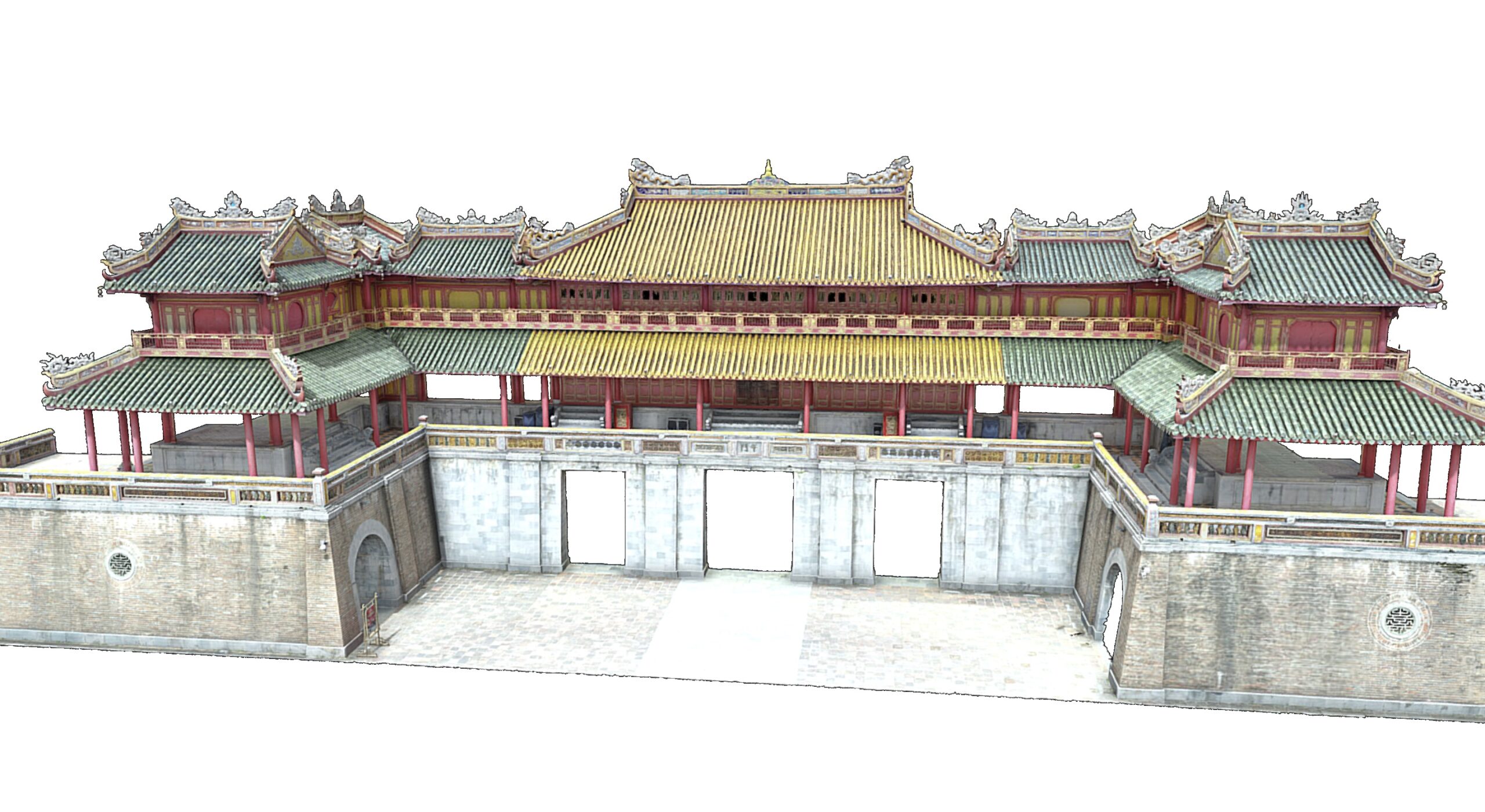
VMT Solutions carried out a fully non-invasive heritage status survey of Ngọ Môn, the main gate of the Hue Imperial Citadel (UNESCO World Heritage Site) in Vietnam.
-
02
The survey combined terrestrial 3D laser scanning, drone photogrammetry and high-resolution photography to record the structure without any physical contact.
-
03
VMTS has since scanned further monuments in the same complex, including Kiến Trung Palace, and applies the same rigour to heritage projects in Europe.
Documenting a historic monument accurately is the first step of any conservation project. It is also one of the hardest, because the structure itself cannot be touched, moved or subjected to destructive measurement. This case study describes how VMT Solutions surveyed Ngọ Môn, the principal gate of the Hue Imperial Citadel in Vietnam, using 3D laser scanning, drone photogrammetry and photography, and what that approach delivered for the conservation team.
Project overview
Project reference · VMTS
Ngọ Môn (Meridian Gate), Hue Imperial Citadel
Heritage status survey to support conservation and restoration planning
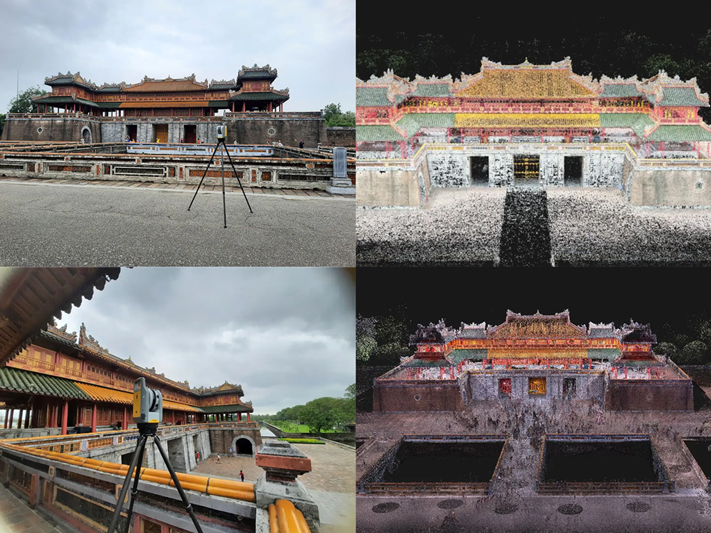
VMT Solutions recorded the current condition of Ngọ Môn with terrestrial 3D laser scanning, drone-based photogrammetry and high-resolution photography, giving the conservation team a reliable geometric reference without any physical contact with the monument.
The challenge: documenting a monument that cannot be touched
Ngọ Môn is the main southern gate of the Hue Imperial Citadel, part of the UNESCO-listed Complex of Hue Monuments. Like most heritage structures of its age and status, its current condition has to be recorded precisely before any conservation or restoration work can be scoped, but the survey itself must be entirely non-invasive: no physical measurement on the fabric, no fixings, no contact that could affect the original substance.
The gate also combines fine architectural detail at ground level with a large tiled roof structure and upper pavilions that are difficult to reach and to measure from the ground. A single capture method would leave gaps.
The approach: terrestrial scanning, drone and photography combined
VMT Solutions surveyed Ngọ Môn with a combination of three techniques, each chosen for what it captures best:
- Terrestrial 3D laser scanning for the accessible facades, openings, columns and decorative stonework at and near ground level
- Drone photogrammetry for the roof structure, ridge details and upper pavilions that cannot be reached or measured safely from the ground
- High-resolution photography for colour, surface condition and material documentation across the whole structure
The work was carried out by the VMTS team of survey engineers and heritage-survey specialists. None of the methods requires physical contact with the monument, so the entire condition record was produced without touching the original fabric.
How VMTS approaches heritage work
European documentation standards, applied to Southeast Asian heritage.
VMTS delivers heritage surveys to a standard tolerance of ±1.5 cm, with tighter tolerances agreed where restoration with prefabricated components requires it. Point cloud registration is checked by staff with a geodetic background before any deliverable is produced. The same workflow is used across VMTS heritage projects in Vietnam and in Europe.
A second project in the citadel: Kiến Trung Palace
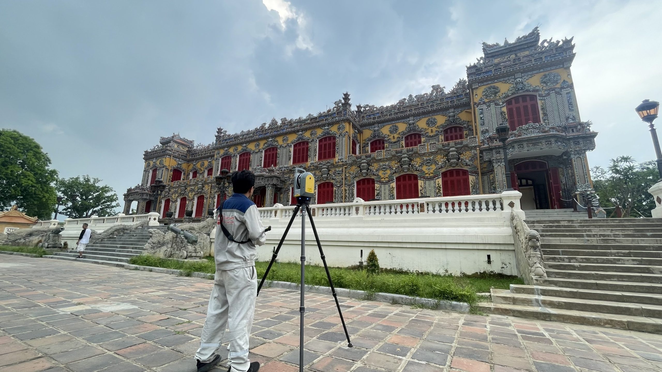
VMT Solutions has since carried out further scanning inside the citadel complex, including a laser-scanning survey of Kiến Trung Palace ahead of Festival Huế 2024. For that project the client needed a high-accuracy point cloud and mesh model of the palace facade as the basis for a 3D projection-mapping light show. The on-site survey was completed in a single day and the data processed within two days, so the design team could start work on schedule.
The same survey data that supports a projection-mapping design can also serve conservation documentation, virtual tours and, where a project calls for it, a BIM model. The capture is done once; the deliverables follow the use case.
The result
The Ngọ Môn survey produced a detailed, accurate record of the gate’s current condition, giving the conservation team a dependable geometric reference for restoration planning, with no physical contact with the heritage structure at any point. Combined with the later work on Kiến Trung Palace, it is part of a growing VMTS record of 3D documentation inside one of Vietnam’s most significant heritage sites.
VMTS heritage documentation: Vietnam and beyond
Heritage documentation is a long-standing part of the VMTS portfolio. Alongside the projects in Hue, VMTS has surveyed and modelled heritage buildings in Europe, including Schloss Laufen in Switzerland, the Staatsbibliothek zu Berlin in Germany, the Ronchamp Chapel by Le Corbusier in France, and the Elders Wool Stores heritage complex in Australia. Where a project requires a native BIM model of a historic building rather than survey documentation alone, that is delivered in Archicad, Revit or Allplan; see our overview of scan-to-BIM for heritage buildings and our guide to Point Cloud to Archicad for historic buildings.
Frequently asked questions
What methods does VMTS use to document heritage buildings?
VMTS combines terrestrial 3D laser scanning for accessible detail, drone photogrammetry for rooflines and hard-to-reach elements, and high-resolution photography for surface and material condition. The methods are selected per project so that the full structure is covered without gaps.
Is 3D laser scanning safe for fragile heritage structures?
Yes. Terrestrial laser scanning, drone photogrammetry and photography are all non-contact methods. Nothing is fixed to or measured directly on the structure, so the original fabric is not affected by the survey.
Does VMTS produce BIM models from heritage scans?
Yes, where a project requires it. VMTS delivers native BIM models of historic buildings in Archicad, Revit or Allplan for European heritage projects. The Ngọ Môn and Kiến Trung Palace projects in Hue were delivered as survey documentation and point cloud or mesh data, which is what those projects called for; the same captured data can be modelled into BIM later if needed.
Where does VMTS carry out heritage documentation projects?
In Vietnam, including the Hue Imperial Citadel, and internationally. VMTS heritage projects include work in Switzerland, Germany, France and Australia, applying the same documentation standards across all locations.
Work with VMTS
Planning a heritage documentation or scan-to-BIM project?
Tell us about the structure and what the survey needs to support. We usually reply within one working day with an initial assessment.
Nguyen Huynh (Rainer)

About the Author:
Nguyen Huynh (Rainer) is Managing Director at VMT Solutions, specializing in Point Cloud to BIM workflows for surveying, planning, and engineering offices. He focuses on precise BIM models, clearly defined quality standards, and long-term technical partnerships.
Share This Story!
Recent Posts

We are proud to have
satisfied customers.

 Gerd Gindullis, Lecturer for digital as-built data capture at Aachen University of Applied Sciences, TerraMeta 3D Laser Service
 Stefan Schramm, Architekt Stefan Schramm
„Your plans are perfect; I’ve never seen anything like this before. These are drawings of the highest quality, I must say. I want to express my sincere thanks once again for your work.“
 Endre Szokolai, Digitalplan-Szokolai
VMT modeled a large industrial building in 3D for our research project. We provided DWG plans to VMT, and they delivered a highly detailed model, including the building envelope, interior walls, openings, and stairs. We had previously contracted a German company for the same object, but unfortunately, it didn’t work out. I was relieved and pleased that VMT handled it so reliably. Thank you for the excellent work and the truly fair price!

Very reliable company, courteous staff, and top-quality work. Our plans were created quickly and accurately. Thank you for that. Highly recommended.
Excellent advice and high 3D modeling quality at a great price-performance ratio… What more could you want? I can highly recommend them…