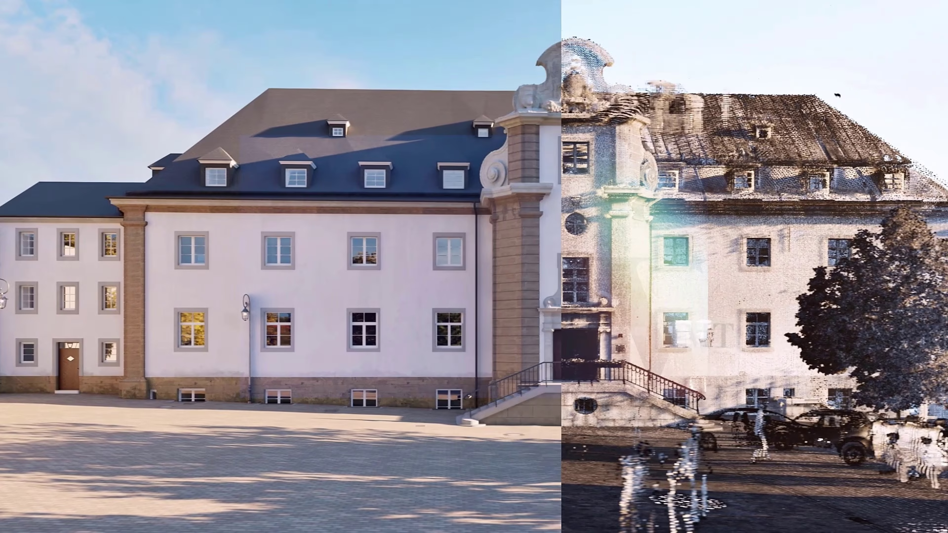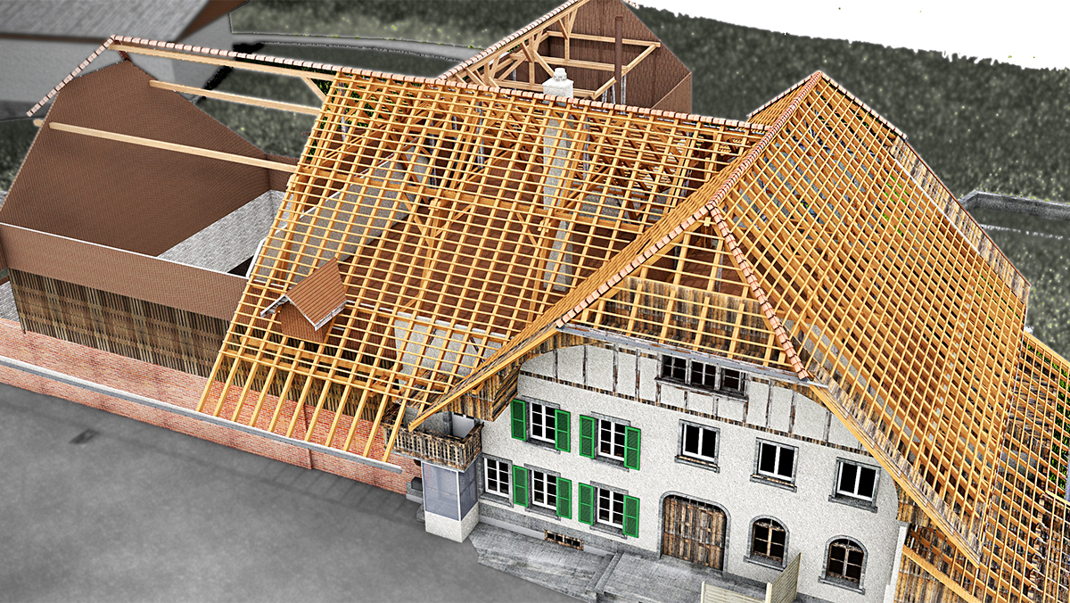
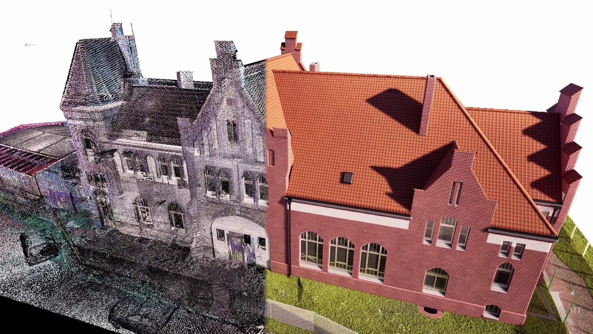
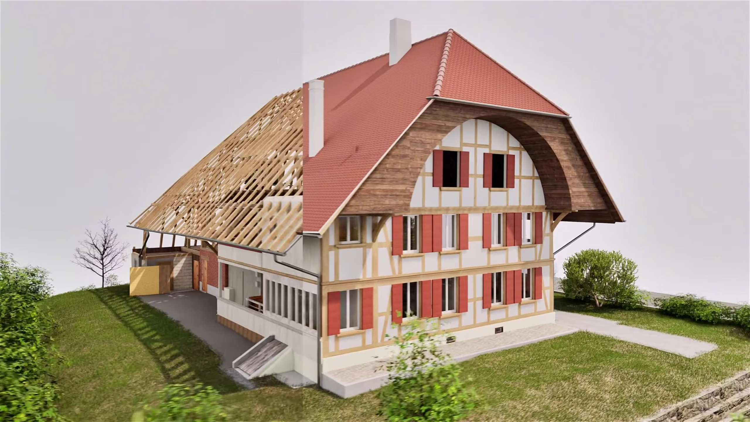
From registered point cloud to 3D Bim model of historic farmhouse
This historic farmhouse was captured by VDE by 3D laser scanning technology. They scanned the interior and exterior of this farmhouse.
From the registered point cloud, we created 2D plans and 3D model in ArchiCAD ( drawing standard: preservation of monuments), which can be used as a basis for the project planning of a conversion.
Related Works
Scan to BIM for MEP – Precise MEP Modeling in ArchicadNguyen Huynh (Rainer)2025-10-10T17:34:18+07:00
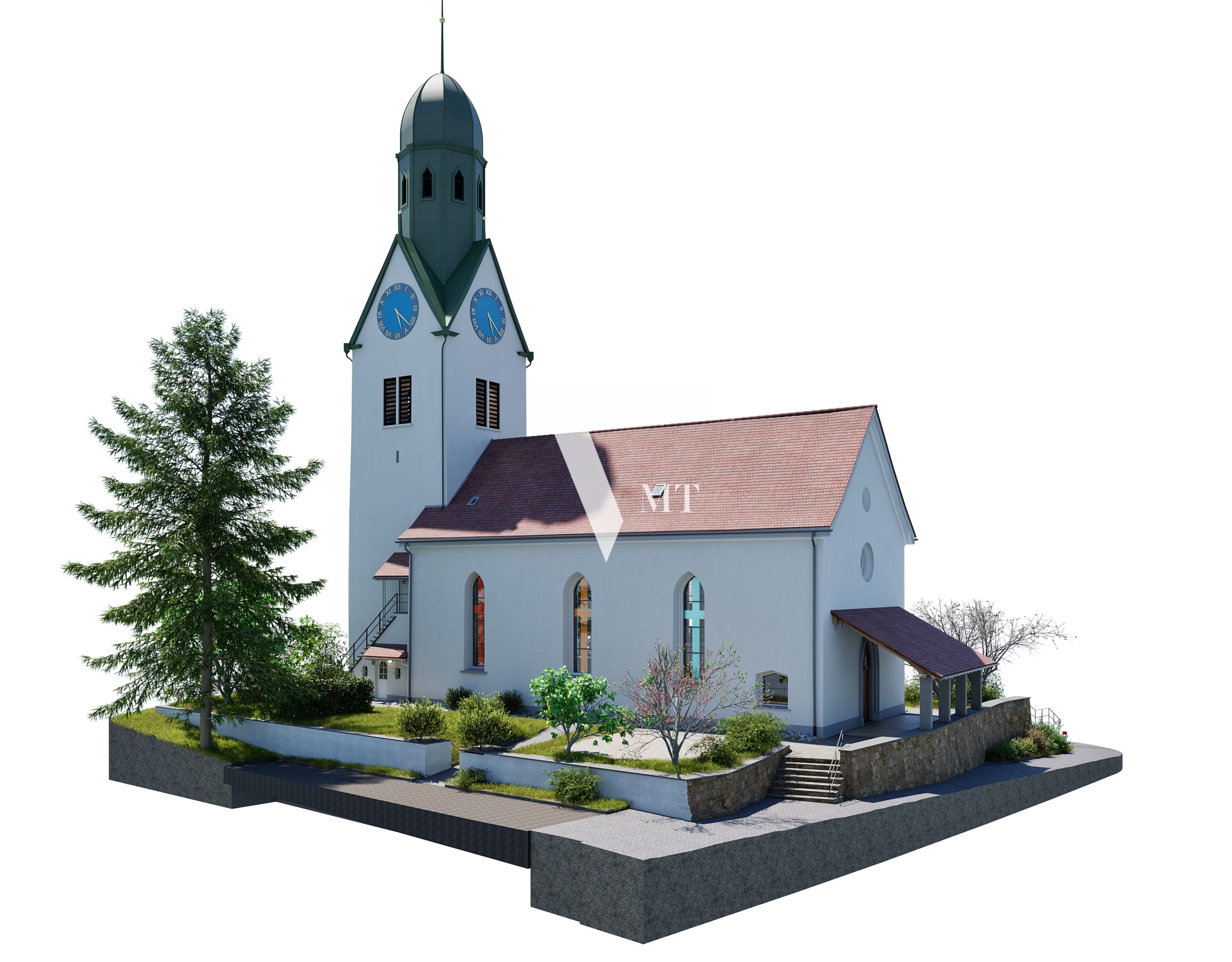
Point Cloud to ArchiCAD Model in Action: The Otelfingen Church ProjectNguyen Huynh (Rainer)2025-07-24T14:09:37+07:00
Point cloud to 3D BIM for the historic Caputh railway station – Heritage preservation with laser scanning and ArchicadNguyen Huynh (Rainer)2026-04-07T22:17:11+07:00
Stunning 3D Visualisation for Architectural Projects with TwinmotionNguyen Huynh (Rainer)2025-04-19T12:56:41+07:00

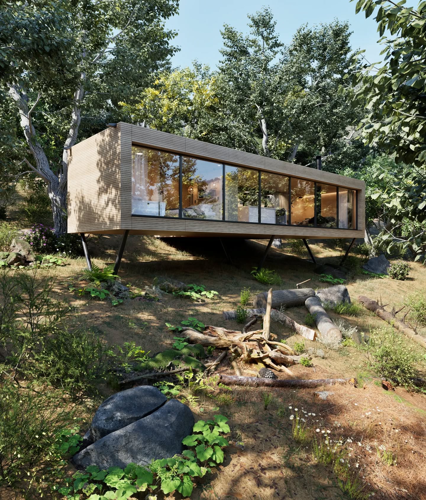
A charming small house Visualization & Drafting ServicesNguyen Huynh (Rainer)2025-04-19T13:12:42+07:00

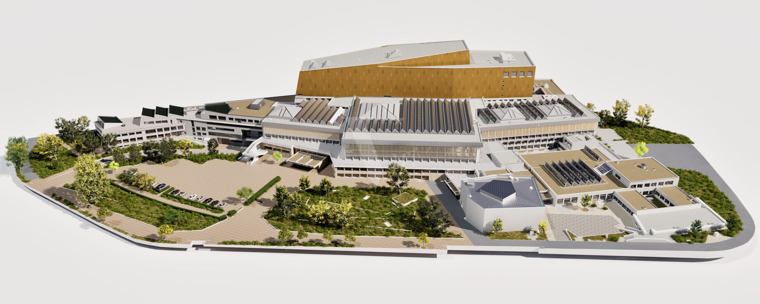
Old Secondary School from Point Clouds in Archicad with LOD Premium (equivalent to LOD 400)Nguyen Huynh (Rainer)2025-04-19T10:24:09+07:00