Recently, we had an insightful discussion with a potential client about a survey project he had just completed. He shared a common concern:
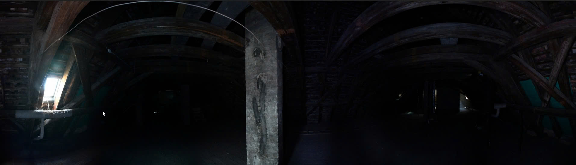
“The survey area is mostly dark. Our Point Cloud has no color data, only intensity. Can we still use this grayscale data? Will accuracy and detail be affected?”
Our answer, based on real project experience, was simple and confident: Absolutely not!
He was surprised — why had every previous CAD partner insisted that Point Clouds must include color, while we claimed to achieve even higher precision using only intensity data?
Listen to Podcast
No time to read? Listen to the podcast version of this article.
Table of Contents
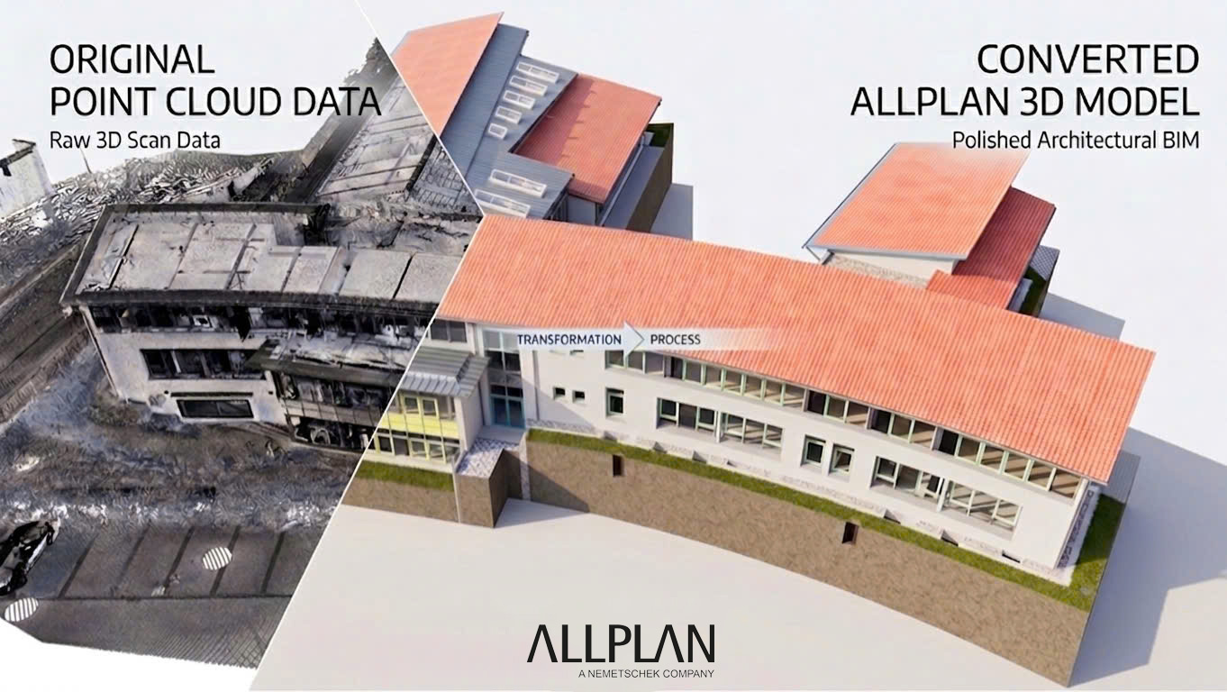
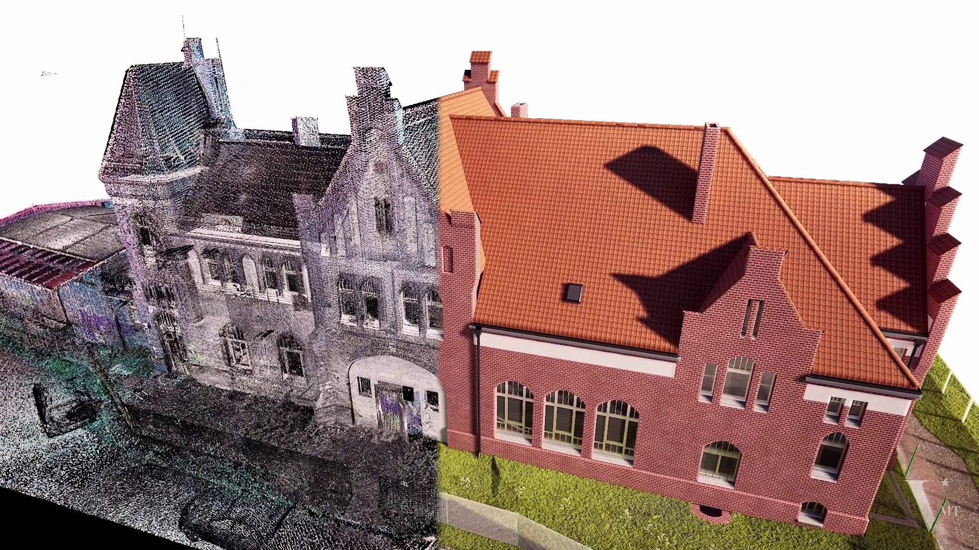
The Truth About RGB Data in Point Clouds
To understand this, we need to look at what RGB color really represents in a Point Cloud:
- RGB Comes from Photos
Color values (Red, Green, Blue) are not generated by the laser scanner itself. They are mapped onto the Point Cloud using photographic images captured by an external camera. - Image Quality Affects Geometry
When images are taken under poor lighting conditions — which is common in real-world surveys — RGB data can actually reduce usability. Noisy, dark, or distorted colors may hide real geometric details and distract from the true structure.
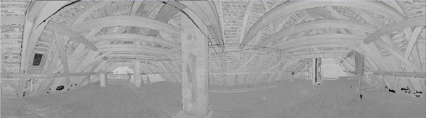
The Advantages of Intensity-Based Point Clouds
By contrast, intensity data records the reflectivity of laser pulses from the surface of objects. This is a direct physical measurement, not influenced by ambient light — and it brings several powerful advantages for 3D modeling (CAD/BIM):
- Optimized Geometric Accuracy
Intensity reveals real surface characteristics, making edges, contours, and material transitions clearer and more reliable than color-based data. - Faster Survey Workflow
Without the need for high-quality photo capture, surveys can be completed faster — a key benefit for large or time-sensitive projects. - Preferred Choice for Precision Projects
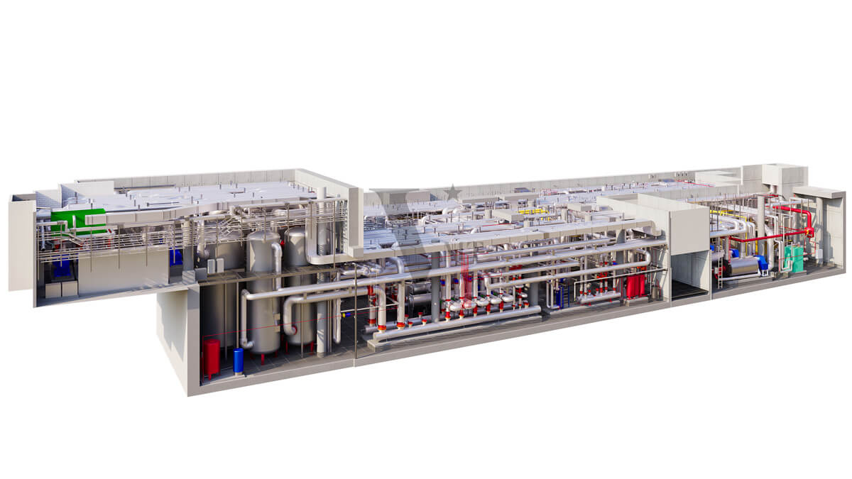
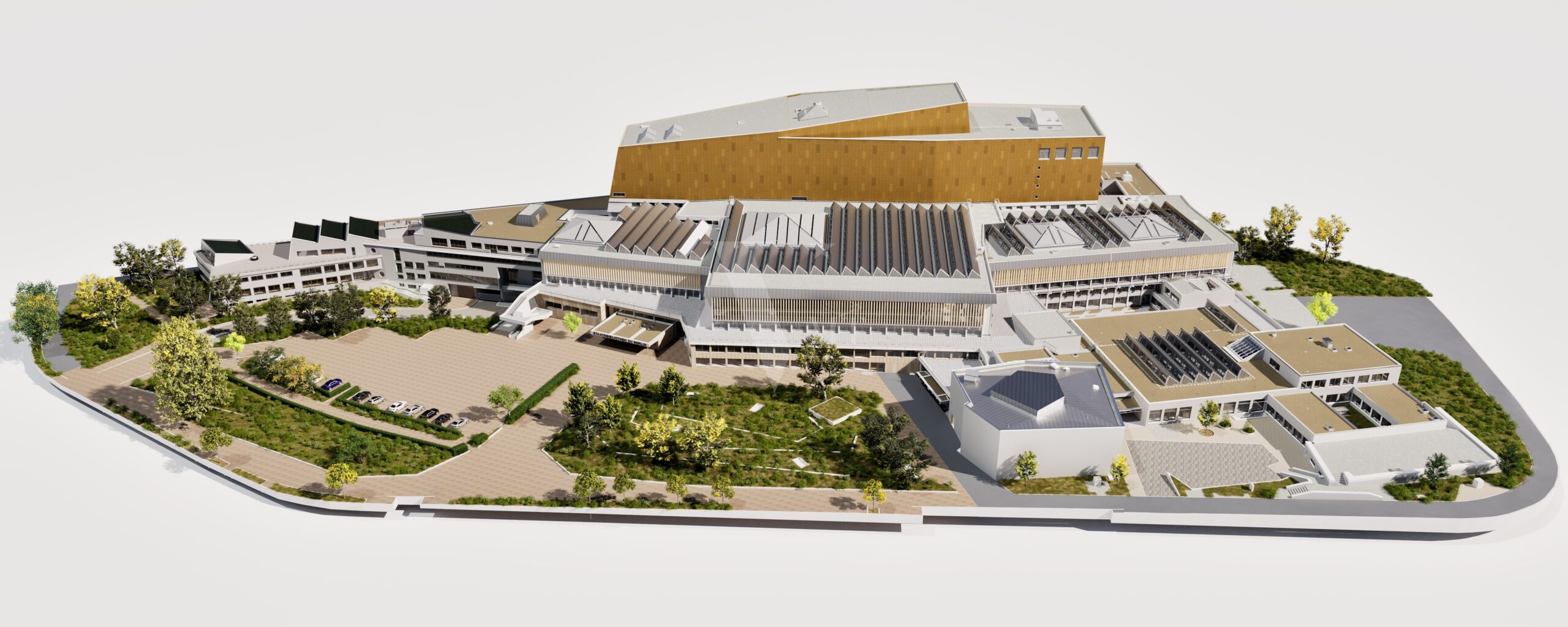
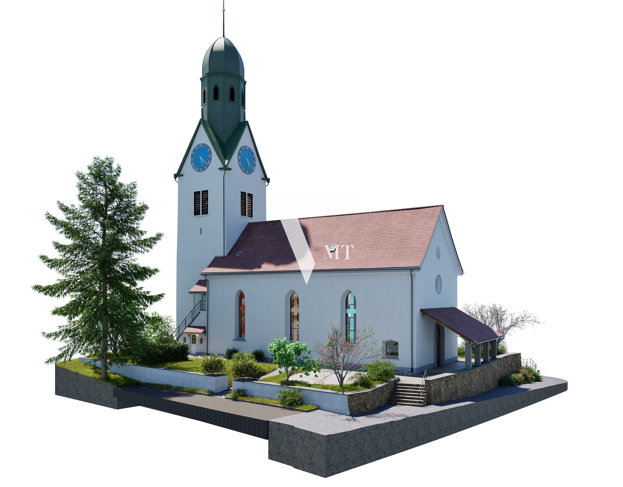
At VMT Solutions, we often perform scanning entirely in intensity mode. For us, geometric precision in CAD/BIM modeling always comes first — color is optional, not essential.
RGB vs. Intensity Point Cloud: A Comparison
| Feature | RGB Point Cloud | Grayscale Intensity Point Cloud |
|---|---|---|
| Data Values | 3 color values (R, G, B) | 1 reflectivity value (Intensity) |
| Source | Indirect – from camera images | Direct – from LiDAR sensor |
| Purpose | Visual recognition (trees, furniture, etc.) | Geometric accuracy and material distinction |
| Light Dependence | High – affected by lighting conditions | Low – independent of ambient light |
| Benefit for CAD/BIM | Provides visual context | Enhances edge clarity and geometric precision |
Overcoming the Challenges of Intensity Data in CAD
Some may think grayscale Point Clouds are harder to interpret in CAD environments.
That’s where VMT Solutions stands out.
Our optimized workflow allows us to fully leverage intensity data by:
- Enhancing contrast and visibility through specialized intensity processing tools.
- Modeling 3D geometry with absolute precision, without relying on “decorative” color layers.
Conclusion
Don’t let RGB requirements slow down your survey or compromise data quality — especially in challenging lighting conditions. Intensity-based Point Clouds are often the most accurate, efficient, and professional choice for 3D modeling.
Contact VMT Solutions to discover our unique workflow and learn how we can deliver the highest precision for your project — no matter the lighting conditions.
Nguyen Huynh (Rainer)
")
About the Author:
Nguyen Huynh (Rainer) is Managing Director at VMT Solutions, specializing in Point Cloud to BIM workflows for surveying, planning, and engineering offices. He focuses on precise BIM models, clearly defined quality standards, and long-term technical partnerships.
Related Posts


Recent Posts


Tag Cloud
We are proud to have
satisfied customers.
 Gerd Gindullis, Lecturer for digital as-built data capture at Aachen University of Applied Sciences, TerraMeta 3D Laser Service
 Stefan Schramm, Architekt Stefan Schramm
„Your plans are perfect; I’ve never seen anything like this before. These are drawings of the highest quality, I must say. I want to express my sincere thanks once again for your work.“
 Endre Szokolai, Digitalplan-Szokolai
VMT modeled a large industrial building in 3D for our research project. We provided DWG plans to VMT, and they delivered a highly detailed model, including the building envelope, interior walls, openings, and stairs. We had previously contracted a German company for the same object, but unfortunately, it didn’t work out. I was relieved and pleased that VMT handled it so reliably. Thank you for the excellent work and the truly fair price!

Very reliable company, courteous staff, and top-quality work. Our plans were created quickly and accurately. Thank you for that. Highly recommended.

Excellent advice and high 3D modeling quality at a great price-performance ratio… What more could you want? I can highly recommend them…