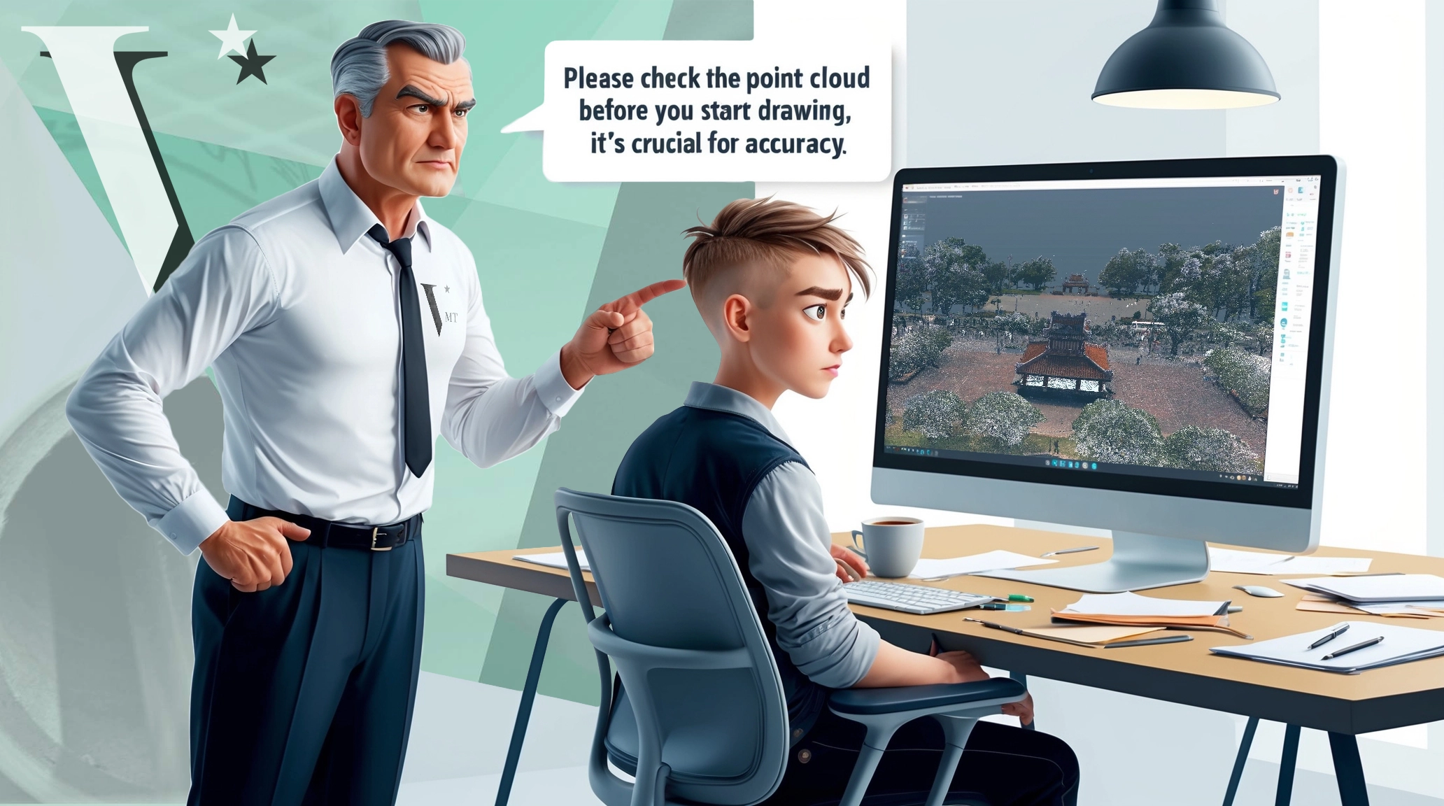
The surveying engineer in the Point Cloud to BIM team plays a crucial role, especially in large projects. They ensure that the point cloud is precise and consistent, which forms the foundation for all subsequent high-precision processes and ultimately guarantees the quality of the 3D BIM model.
Table of Contents
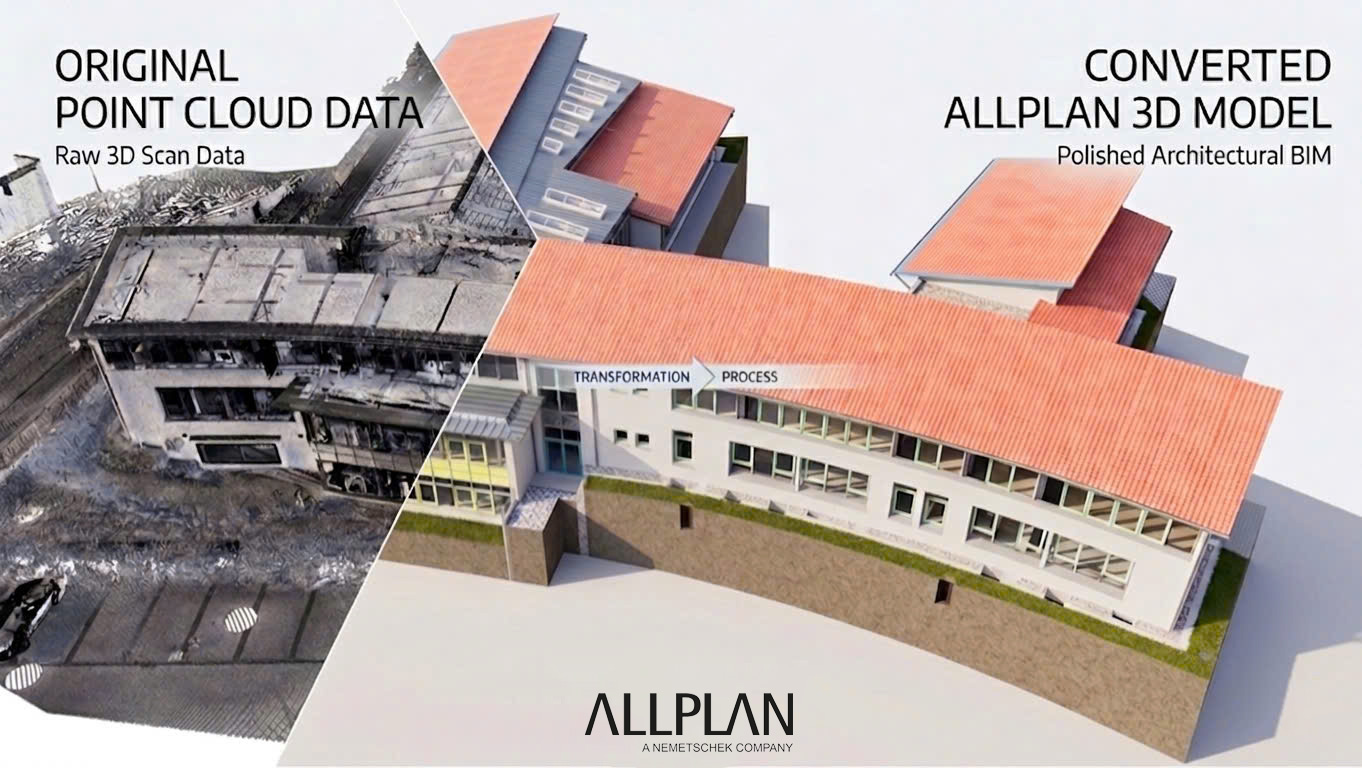
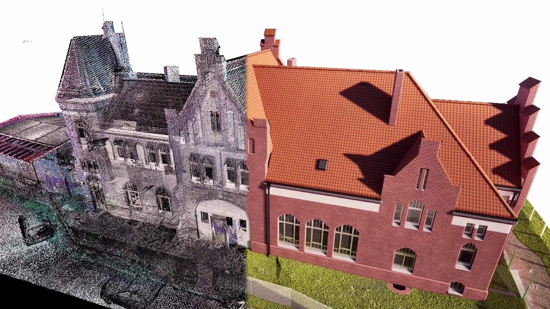
Lessons from 10 Years Ago: The Challenges of Processing Point Cloud to BIM
Over a decade ago, we started converting point clouds into 3D models with a small team of just five architects. Those early days were challenging, filled with numerous obstacles. One of the biggest issues was the lack of appropriate software and plugins for processing point clouds, most of which were prohibitively expensive. (Even AutoCAD only allowed point cloud imports starting with the 2011 version.)
Another significant challenge we faced was point cloud misalignment. With the technology available 10 years ago, almost every point cloud provided by clients had some degree of error, sometimes severe. The registration algorithms at the time were prone to mistakes, often producing “green” reports that misleadingly indicated everything was correct. To address this, we often had to manually redraw the entire dataset in 2D and then painstakingly piece the elements together to ensure accuracy. This labor-intensive and time-consuming process consistently earned us high praise from clients for the precision of our 3D models. At that time, we didn’t have the support of a surveying engineer and didn’t realize we needed one.
Present-Day Advantages in Point Cloud to BIM Processing
Today, we are fortunate to have powerful software tools and much more accurate 3D laser scanners at our disposal. These technological advancements have made the manual, time-consuming processes of the past obsolete. However, thoroughly checking the point cloud before transitioning to 3D modeling remains a crucial step. Two of our surveying specialists handle this critical task, ensuring that even minor deviations of just a few millimeters are detected and corrected. We then provide our clients with a detailed report of all adjustments made.
Interestingly, while the error rate has decreased from 100% a decade ago to over 50% today, the volume of projects requiring careful review and correction keeps our team busy. We now face new challenges brought on by emerging technologies like mobile mapping. Today, the role of the surveying engineer is essential in checking and correcting all point clouds, making the surveying engineer indispensable in Point Cloud to BIM projects.
The Surveying Engineer in the Point Cloud to BIM Team
The Role of the Surveying Engineer in the Point Cloud to BIM Team
Challenges from New Technologies
Mobile mapping has emerged as an attractive solution for quickly and easily capturing data over large areas. However, this convenience comes with significant drawbacks. For example, using mobile scanners for high-precision projects, such as those requiring exact measurements for window replacements, isn’t always appropriate. Clients often expect accuracy within ±10 mm, which we cannot guarantee due to the limitations of the input data and equipment.
Furthermore, combining data from mobile scanners, terrestrial scanners, and drone photogrammetry can lead to complex integration issues. While the final output may appear as a unified 3D model, a deeper analysis often reveals discrepancies due to varying degrees of accuracy among the different data sources. In large projects over 200,000 square meters, these issues become particularly pronounced, and accuracy can be severely impacted. In such cases, the expertise of a surveying engineer is crucial for identifying the most accurate dataset and using it as a reference for the alignment process.
Conclusion
Creating an accurate 3D BIM model from point cloud data, especially for large projects, requires the involvement of a surveying engineer who can ensure that the point cloud is precise and consistent. This forms the foundation for the high-accuracy processes that follow. Surveying companies with in-house CAD teams recognize the importance of this and understand that outsourcing the drafting work can be risky if the CAD company lacks the ability to correct point cloud errors.
I hope this article helps you identify potential issues in high-precision projects, especially those involving multiple survey methods. If you outsource such projects to an external CAD team, it’s crucial to remind them regularly to report any point cloud errors immediately and not attempt to resolve them on their own.
FAQs
Why is the Surveying Engineer’s Role Essential in the Point Cloud to BIM Team?
The surveying engineer in the Point Cloud to BIM team plays a crucial role, especially in large projects. They ensure that the point cloud is precise and consistent, which forms the foundation for all subsequent high-precision processes and ultimately guarantees the quality of the 3D BIM model.
Nguyen Huynh (Rainer)
")
About the Author:
Nguyen Huynh (Rainer) is Managing Director at VMT Solutions, specializing in Point Cloud to BIM workflows for surveying, planning, and engineering offices. He focuses on precise BIM models, clearly defined quality standards, and long-term technical partnerships.
Related Posts


Recent Posts


Tag Cloud


We are proud to have
satisfied customers.
 Gerd Gindullis, Lecturer for digital as-built data capture at Aachen University of Applied Sciences, TerraMeta 3D Laser Service
 Stefan Schramm, Architekt Stefan Schramm
„Your plans are perfect; I’ve never seen anything like this before. These are drawings of the highest quality, I must say. I want to express my sincere thanks once again for your work.“
 Endre Szokolai, Digitalplan-Szokolai
VMT modeled a large industrial building in 3D for our research project. We provided DWG plans to VMT, and they delivered a highly detailed model, including the building envelope, interior walls, openings, and stairs. We had previously contracted a German company for the same object, but unfortunately, it didn’t work out. I was relieved and pleased that VMT handled it so reliably. Thank you for the excellent work and the truly fair price!

Very reliable company, courteous staff, and top-quality work. Our plans were created quickly and accurately. Thank you for that. Highly recommended.

Excellent advice and high 3D modeling quality at a great price-performance ratio… What more could you want? I can highly recommend them…