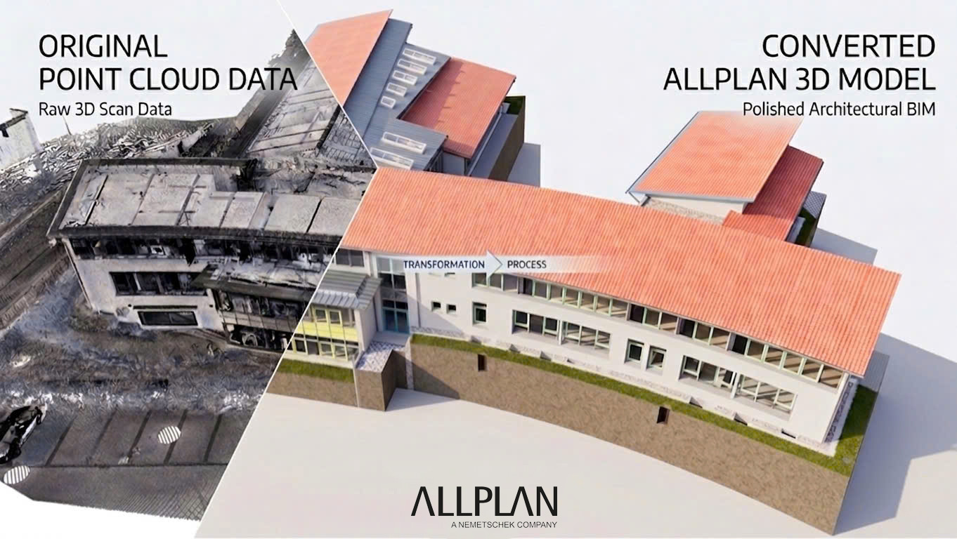
In the context of the construction industry increasingly demanding accuracy, efficiency, and optimization in project management, new technologies such as BIM and Point Cloud have revolutionized the approach and operation of projects. The process of creating a BIM model from Point Cloud data is the bridge that enables builders to transform real-world data, collected by 3D laser scanning devices, into complete digital models suitable for design, analysis, construction, and maintenance purposes.
In this article, let’s go through the reasons why applying this process is so important and revolutionary for the construction industry. At the same time, understanding BIM and Point Cloud data is the foundation for diving into the detailed sections that follow.

Table of Contents
Introduction to BIM and Point Cloud
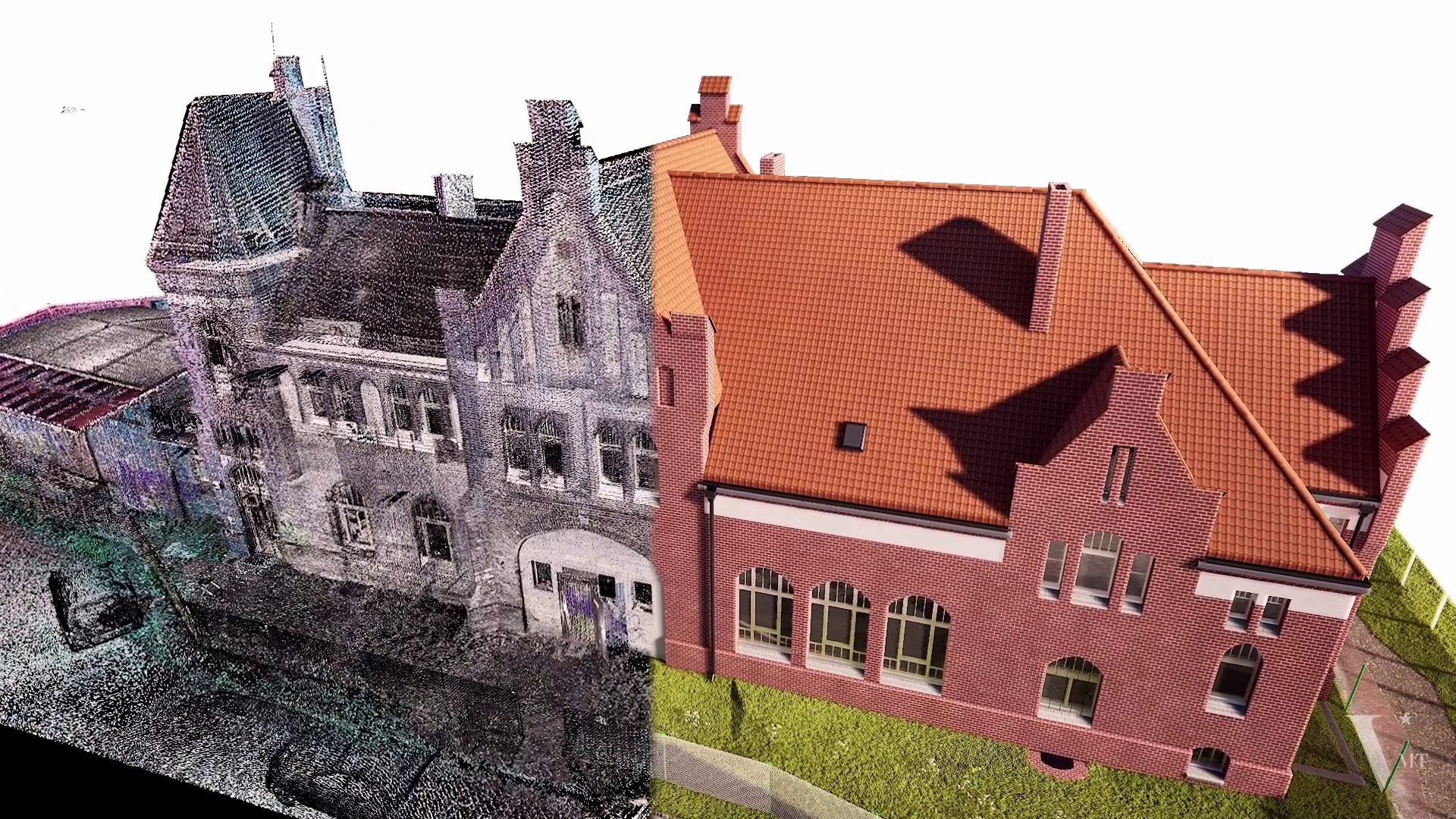
BIM (Building Information Modeling) is an intelligent data model that integrates all information about a construction project in digital form. It is not merely a 3D drawing but also a platform containing data about materials, structures, quantities, technical and management aspects. BIM allows project stakeholders to manipulate, analyze, and check the model flexibly and accurately, thereby minimizing risks, technical errors, and future repair costs.
Meanwhile, Point Cloud is a collection of spatial data points, captured through 3D laser scanning devices or UAVs, accurately reflecting the shape and position of real-world objects and structures. It provides a panoramic view of the project with high resolution, potentially including millions or even billions of data points, offering a realistic data foundation for creating detailed digital models.
The Role of Point Cloud in Creating BIM Models
Point Cloud data is the key to accurately and quickly transforming reality into a digital model. Once collected, this data helps engineers better understand the space and structure of the project, including even the smallest details, without having to measure manually or redraw from scratch.
In the BIM modeling process, Point Cloud not only ensures the model’s accuracy but also provides the foundational data for analyzing the viability of old components, checking design deviations, or detecting technical errors in time. As a result, projects become significantly more transparent, precise, and efficient.
Applications of the BIM-from-Point-Cloud Process in Construction and Asset Management
In practice, the process of creating BIM from Point Cloud data offers great benefits across various project stages, such as:
- Design and cost estimation: Accurate models help reduce disputes, improve cost estimate accuracy, and ensure the design better fits reality.
- Construction: Point Cloud data provides a basis for comparison, progress checks, and quick measurement of deviations from the original design.
- Maintenance and asset management: BIM models provide a clear visualization of the condition of completed projects, supporting future maintenance, repair, and upgrade activities.
- Safety and quality control: Scanned data analysis helps identify durability issues, deviations, or damage in a timely manner during operation.
>> Learn more about our 3D BIM Modeling from Point Cloud service.
Basic Concepts
To systematically and comprehensively explore the process of creating a BIM model from Point Cloud data, we need to master the basic concepts to effectively combine them in practical work.
What is BIM?
BIM (Building Information Modeling) is a comprehensive modeling method based on digital data, allowing the integration of information about architecture, structure, MEP, project management, and facility operations into a single system. BIM enables simulation of the construction process, inspection, and effective management of activities from design to maintenance.
The process of creating a BIM model integrates data from various sources, including Point Cloud data, to produce accurate digital models that reflect the actual state of the project. This enables engineers and project managers to make informed decisions, reduce risks, and optimize resources.
What is Point Cloud?
Point Cloud is a dataset consisting of points in 3D space, scanned using laser devices or UAVs, accurately depicting the shape and structure of real-world objects. These points reflect the cross-sections, contours, surroundings, and depth of building elements, enabling the creation of highly detailed digital models.
Point Cloud data often contains millions of points, each with x, y, z coordinates and additional attributes such as color and reflectivity. Point Cloud processing software can filter, classify, and convert them into data formats suitable for BIM modeling.
The Relationship and Complementarity between Point Cloud and BIM
These two concepts are no longer separate but go hand in hand, complementing each other. Point Cloud provides accurate real-world data for creating BIM models, ensuring the model reflects the actual condition of the project. For inspections or upgrades of old buildings, Point Cloud data helps produce precise digital replicas for analysis, surveys, and renovation design.
Conversely, BIM models created from Point Cloud data allow managers, engineers, and technicians to easily access, edit, and analyze by layers or specific purposes. This connection creates an intelligent, flexible, and efficient ecosystem for long-term asset management.
Preparing Point Cloud Data
Preparing Point Cloud data is the foundational step that determines the success of the entire BIM modeling process. If the collected data lacks quality or is not processed properly, the final result will be negatively affected.
In this section, we will delve into data collection, processing, and standardization methods to prepare for the next step of accurately and efficiently importing data into BIM modeling software.
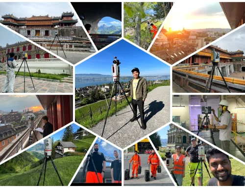
Data Collection Methods (3D laser scanning, UAV, mobile scanners…)
Point Cloud data collection methods are diverse and depend on the project requirements, site conditions, and desired accuracy.
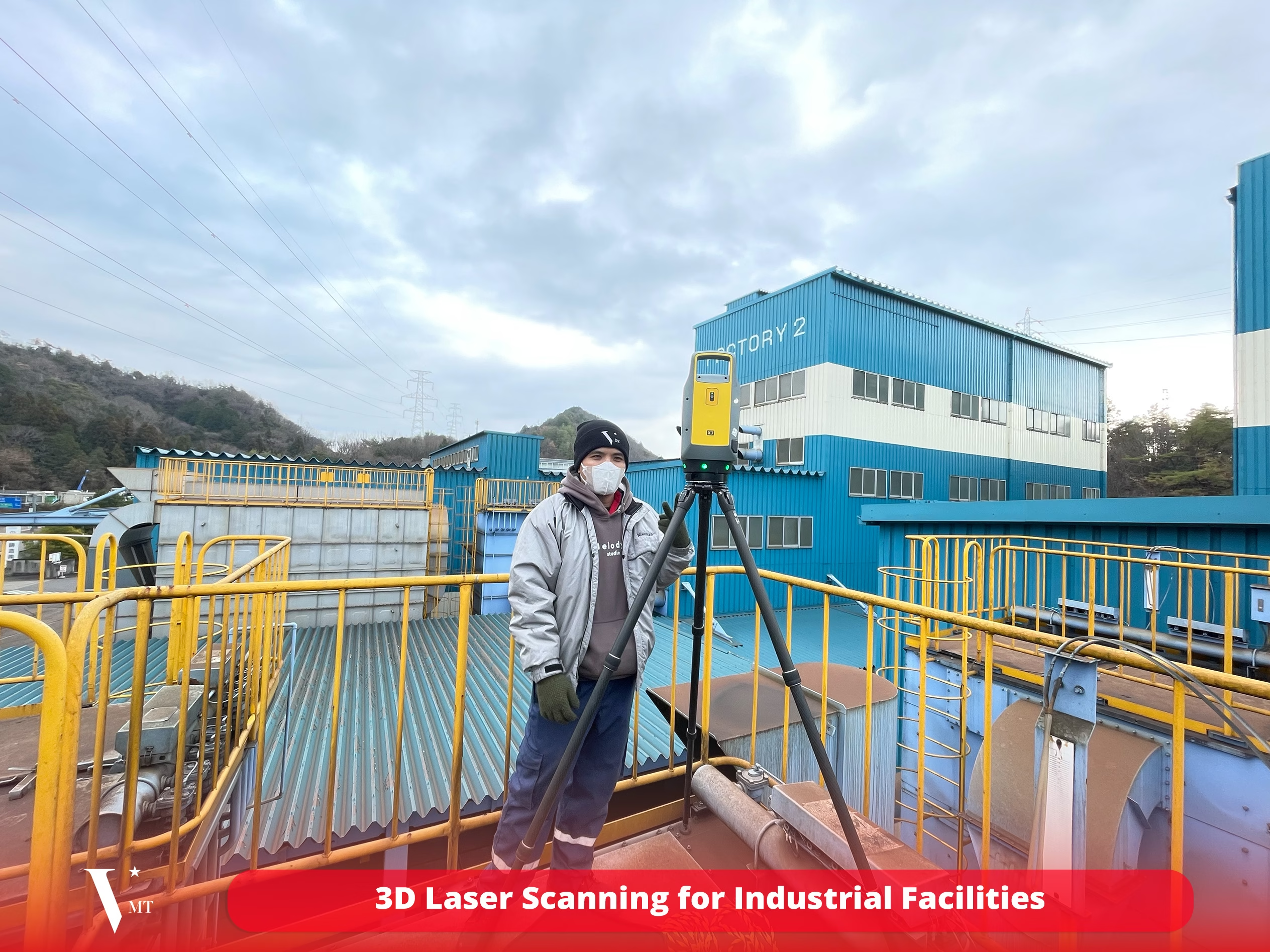
3D Laser Scanning
This is the most common method for collecting Point Cloud data. With the support of laser scanning devices, data is collected directly on site, producing highly accurate data points suitable for projects requiring high technical precision. The 3D laser scanner can be moved freely around the structure, scanning from multiple angles to ensure wide coverage and high accuracy. This process requires skilled technicians to operate the equipment effectively for optimal results.
UAV (Drone)
Drones equipped with cameras or laser scanning sensors can access hard-to-reach areas, collecting data quickly and efficiently, making them ideal for large-scale projects or sites with a wide scope. Drone scanning is particularly suitable for high-rise buildings, outdoor construction sites, or challenging terrains. However, the accuracy of UAV scans is generally lower than that of stationary laser scanning, so it is often combined with other methods to optimize the data.
Mobile Mapping
This is a laser scanning technology mounted on moving vehicles such as cars, trucks, or specialized mobile systems. It is suitable for scanning large areas, complex surfaces, as well as completed structures during comprehensive survey campaigns. The advantages include speed, wide-area data capture, and suitability for urban asset management or infrastructure projects.
Processing Raw Data: Noise Filtering, Standardization, Classification
After collection, Point Cloud data often contains a lot of noise, outliers, or lacks clear classification of building components, requiring thorough processing to be ready for modeling.
Noise Filtering
Raw data usually contains anomalies and noise caused by environmental factors or imperfections in scanning technology. Using Point Cloud processing software helps remove irrelevant points, reduce data size, and increase model accuracy. Filtering and classification also help distinguish object layers such as walls, columns, floors, and roofs for smoother subsequent processing steps.
Data Standardization
Standardization includes editing, correcting distortions, or aligning data to a unified coordinate system and methodology to ensure model accuracy. Today, software like Leica Cyclone and Faro Scene are powerful tools for performing these operations easily and precisely.
Classification and Preparing Data Formats
Classifying Point Cloud points into layers or object types makes it easier to extract and use them in BIM modeling software. Data should also be converted into standard formats such as LAS, LAZ, E57, or RCS, suitable for import into modeling software.
Data Formats and Preparing for Import into BIM Software
After processing, the data must be prepared in a suitable format optimized for BIM software. Common formats include:
- LAS/LAZ: Standard formats for Point Cloud data, widely used in laser data processing software.
- E57: A format that supports storing various types of data, suitable for conversion and integration.
- RCS: Native format of Faro Scene, easy to process and edit.
At this stage, it is important to thoroughly check to ensure the data is error-free or has not been lost during conversion, to achieve the most accurate and detailed modeling results possible.
The Process of Creating a BIM Model from Point Cloud Data
Once the data is well-prepared, we proceed to the main process of building the BIM model from Point Cloud data. This process requires accuracy, meticulousness, and technical expertise to ensure the model not only reflects reality but also serves purposes such as design, construction, or management.
These steps are organized in a logical order, starting from importing the data, aligning, analyzing, extracting, modeling, checking, editing, and finally publishing the completed model.

Step 1: Import Point Cloud Data into BIM Software
This is the initial step to bring the data into the processing environment, creating a working setup for the next stages. Depending on the software used, the user must choose the correct data format and check the integrity of the dataset.
Typically, software such as Autodesk Revit, Navisworks, or specialized tools like Cyclone and Faro Scene support importing Point Cloud data in many common formats. When importing, attention should be paid to scale, coordinate systems, and relevant settings to ensure the data is not distorted or misaligned. These programs also offer tools for preliminary review, allowing early detection of errors or noise.
Step 2: Coordinate Alignment and Data Adjustment
Point Cloud data from the collection process is not always perfectly accurate in terms of coordinates and may contain minor errors. Therefore, this alignment step is crucial to ensure the data matches the predefined project scales and coordinate systems.
Software tools such as transformation commands, manual or automatic adjustments help determine reference points and align the data to a common coordinate system. This also removes discrepancies or positional deviations, ensuring precise data integration within the model.
Step 3: Analysis and Extraction of Structural and Building Components
From the aligned Point Cloud data, engineers analyze and classify parts of the building such as walls, ceilings, columns, MEP systems, and components that are hard to identify in raw data. This requires skill and specialized software like Autodesk Revit, Civil 3D, or Navisworks for comparison, separation, and extraction of relevant elements.
This process can use automatic or semi-automatic algorithms to recognize lines and objects. Additionally, combining with images, structural analysis, and supplementary surveys ensures better object identification for modeling. This step transforms raw data into prototype components, with software creating appropriate model layers based on real-world data.
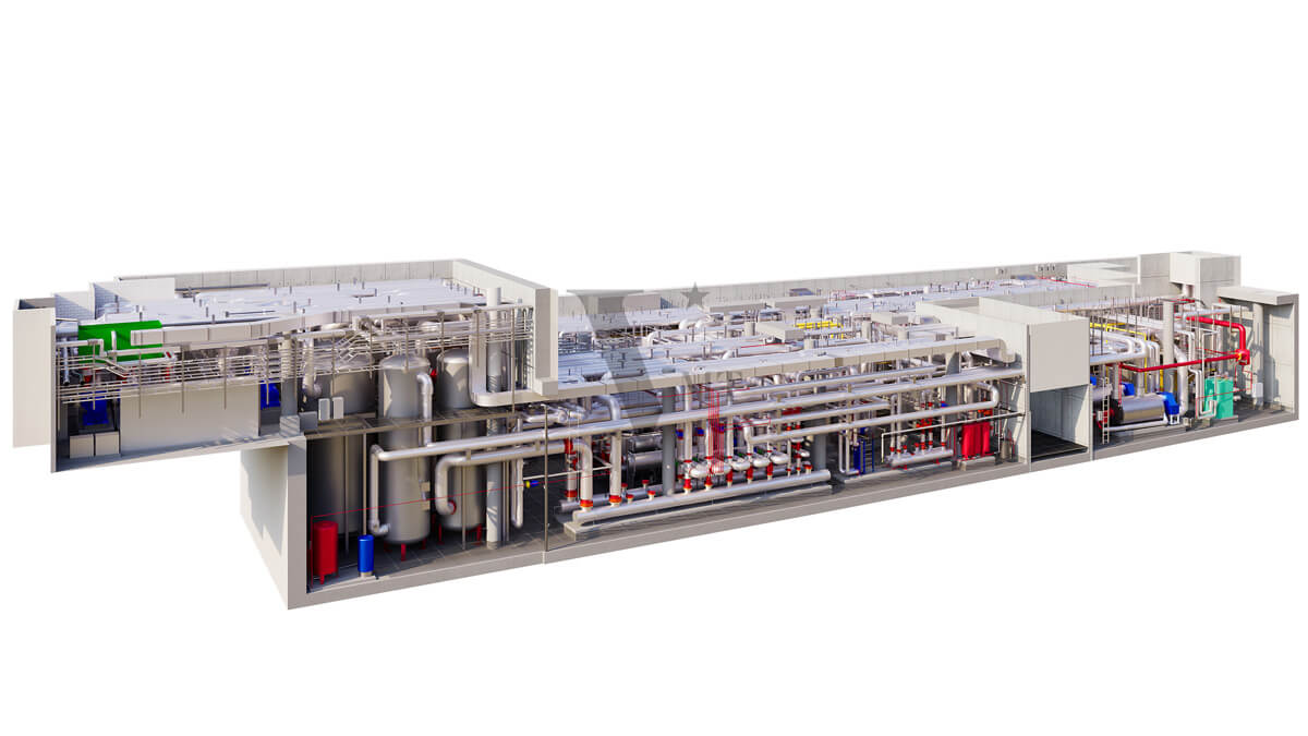
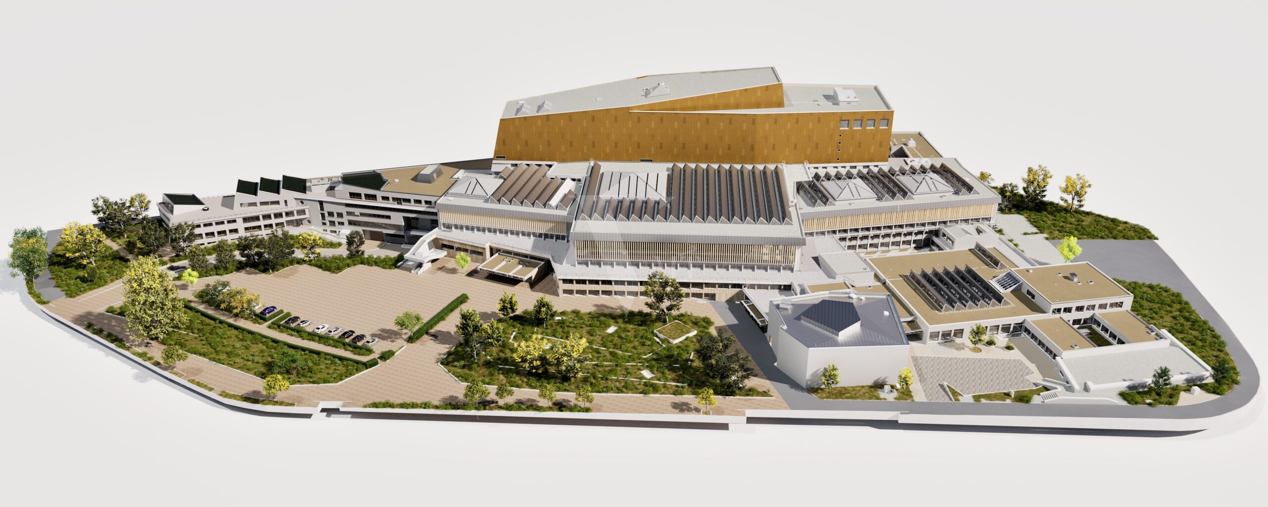
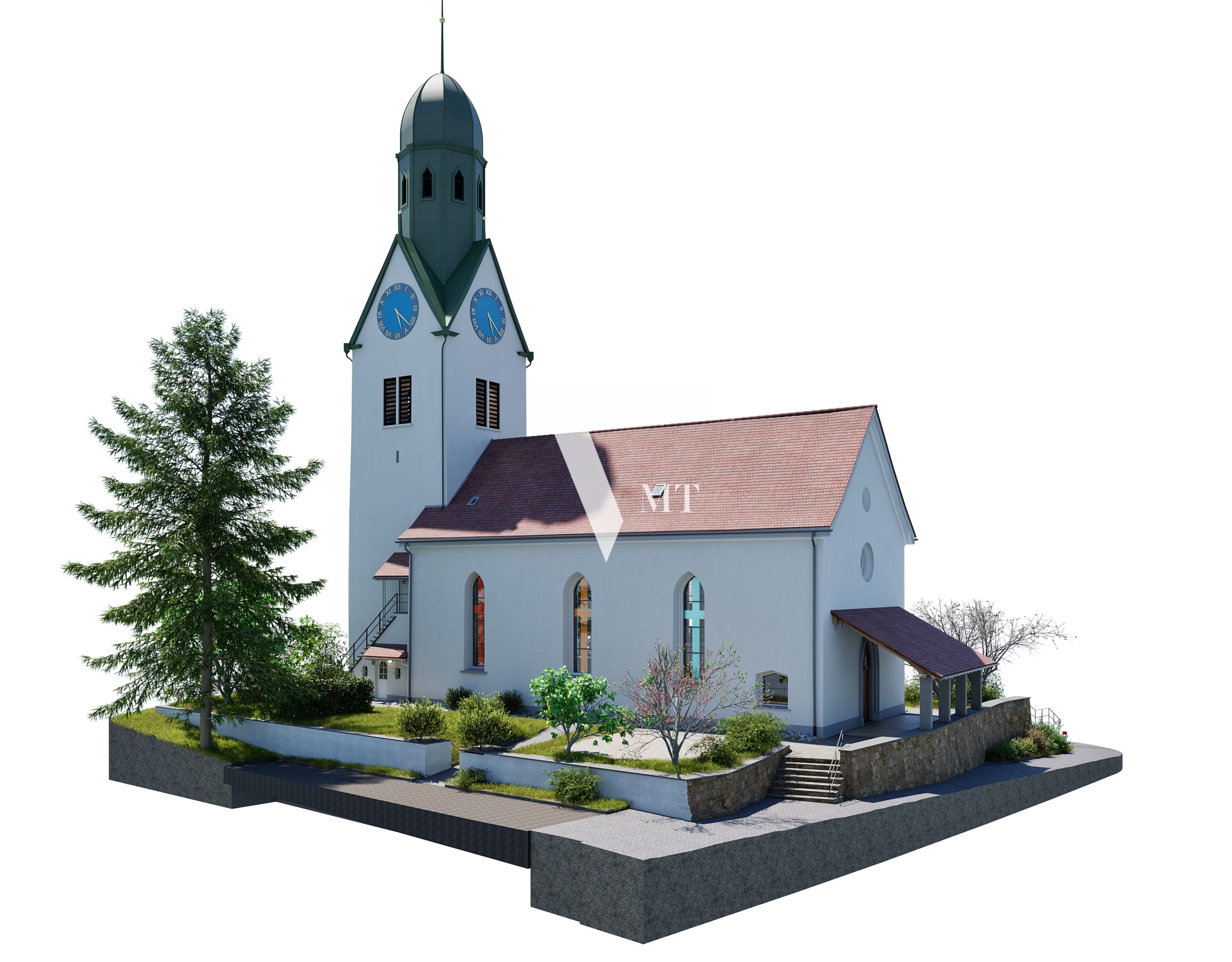
Step 4: Detailed Modeling by Architectural and Structural Components
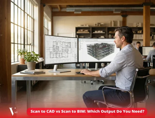
Based on the classified objects, engineers start the modeling process in suitable BIM software such as Revit or ArchiCAD. Components like walls, floors, roofs, columns, and MEP systems are placed on separate layers, using editing and drawing tools to accurately simulate the project design.
In this phase, modeling goes beyond basic shapes to include technical details, materials, dimensions, thickness, hole positions, and related structures. A key advantage of this process is the ability to update and modify easily in the digital environment, saving time and effort compared to manual methods.
Step 5: Building Detail Levels (Level of Detail – LOD) According to Client Requirements
In practice, BIM models vary in detail levels, known as Level of Detail (LOD). Depending on their purpose—design, construction, or facility management—the models are customized accordingly.
Commonly, construction projects use LOD grids such as LOD 100, LOD 200, LOD 300, LOD 400, or LOD 500, representing levels of precision from conceptual to highly detailed. This includes accurate component representation along with technical attributes, materials, dimensions, and positioning. Building these layers helps stakeholders coordinate, track progress, and ensure quality at each stage.
Step 6: Checking, Editing, and Finalizing the BIM Model
After creating the initial model, engineers thoroughly check for inaccuracies, overlaps, and technical errors. Comparing the newly created model with the original Point Cloud data identifies points lacking precision, which are then corrected to improve accuracy.
Software like Navisworks and Solibri support model validation against construction standards and regulations. This ensures the model is technically accurate, matches reality, and meets project requirements. Once corrections are complete, the model becomes a final, precise version ready for further use.
Step 7: Exporting the BIM Model File (RVT, IFC, DWG…)
Finally, the completed BIM model is exported to formats suitable for the intended software or usage, such as RVT (Revit), IFC (for open systems), and DWG (AutoCAD). This facilitates easy sharing and coordination of data between departments, contractors, consultants, and project managers.
Depending on requirements, models can be divided into parts for separate processing or collaborative work online via cloud platforms. Accurate file export in the correct format also streamlines the data conversion process, reduces errors, and increases flexibility in usage.
Popular Supporting Software and Tools
In the process of creating a BIM model from Point Cloud data, the support of specialized software is essential to ensure accuracy, efficiency, and time savings. Below are the most popular and reliable software tools in this field today, along with their key features.
Point Cloud Processing Software: Leica Cyclone, Faro Scene…
Leica Cyclone and Faro Scene are two of the leading Point Cloud processing software solutions on the market today. Each offers unique features suited to different project requirements, scales, and data types.
- Leica Cyclone excels at handling large datasets, supporting editing, analysis, and conversion into formats compatible with BIM software such as Revit or AutoCAD. Cyclone also offers automatic classification, noise filtering, and generation of high-density surfaces for 3D models.
- Faro Scene is specialized for Faro laser scan data, easy to use, and integrates editing, extraction, and point classification tools. It is well-suited for medium to small-scale projects, particularly for site surveys and inspection tasks.
BIM Modeling Software: Autodesk Revit, ArchiCAD, Navisworks…
Popular BIM modeling software such as Autodesk Revit, ArchiCAD, and Navisworks all have the ability to import, edit, and analyze Point Cloud data, especially for high-level construction, architectural, or engineering projects.
- Autodesk Revit is the most widely used software in construction, integrating multiple tools for component modeling, MEP system design, and technical analysis and checks. Revit also allows direct linking to Point Cloud data to assist in extracting elements.
- ArchiCAD is well-suited for architectural design projects, capable of integrating Point Cloud data to create accurate models that reflect real-world conditions.
- Navisworks is mainly used for reviewing, coordinating, and viewing models during construction and project management, making it easy to check for clashes between systems.
Notes and Challenges When Creating BIM from Point Cloud
Although highly beneficial, the process of creating a BIM model from Point Cloud data presents several challenges. Understanding these will help engineers and project managers be more proactive during implementation.
Large Data Volumes Requiring Powerful Hardware
Point Cloud data can be extremely large, reaching hundreds of GB or even TB depending on the project. This requires powerful hardware with sufficient RAM, fast CPUs, and SSD storage to process the data within a reasonable timeframe. Additionally, specialized software requires high system specifications, so hardware optimization is crucial to avoid lag or crashes and to maintain work efficiency.
Scan Data Accuracy Affects Model Quality
The quality of Point Cloud data directly determines the accuracy of the final model. Factors such as scan resolution, weather conditions, lighting, scanning technique, and scanning positions all affect the collected data. Therefore, skill and experience in the collection process are essential to avoid hard-to-correct errors later.
Technical Expertise and Modeling Skills
Point Cloud data requires in-depth processing and analysis, demanding highly skilled technicians proficient in specialized software. This is not merely a technical operation—it also requires knowledge of architecture, engineering, and structural systems to interpret the data accurately and avoid unwanted deviations.
Time and Cost Considerations
The processes of data collection, processing, and modeling are time-consuming and require highly qualified personnel. This can increase project costs, especially for large and complex projects. Careful planning and process optimization are therefore necessary to minimize time and costs.
Applications and Benefits of the BIM Creation Process from Point Cloud
Implementing the BIM modeling process from Point Cloud data delivers outstanding results, improving work efficiency and optimizing resource use in the long term.
Applications in Construction, Renovation, Maintenance, and Asset Management
Point Cloud data accurately recreates all components of a structure, serving surveying, renovation, upgrading, or routine maintenance projects. By identifying the condition of components and detecting damage or wear over time, managers can plan suitable repairs or upgrades, minimizing unexpected costs.
Improved Project Management Efficiency and Stakeholder Coordination
Sharing BIM model data directly from Point Cloud allows all stakeholders to access, update, and review the model throughout the process. This increases transparency, reduces discrepancies, and fosters cooperation and coordination among technical teams, contractors, and investors.
Time, Cost Savings, and Reduced Construction Risks
Compared to manual methods, creating models from Point Cloud data significantly shortens preparation, inspection, and simulation stages. The accuracy achieved helps avoid design errors, reduces unnecessary revisions, and thus saves costs while improving project outcomes.
Conclusion
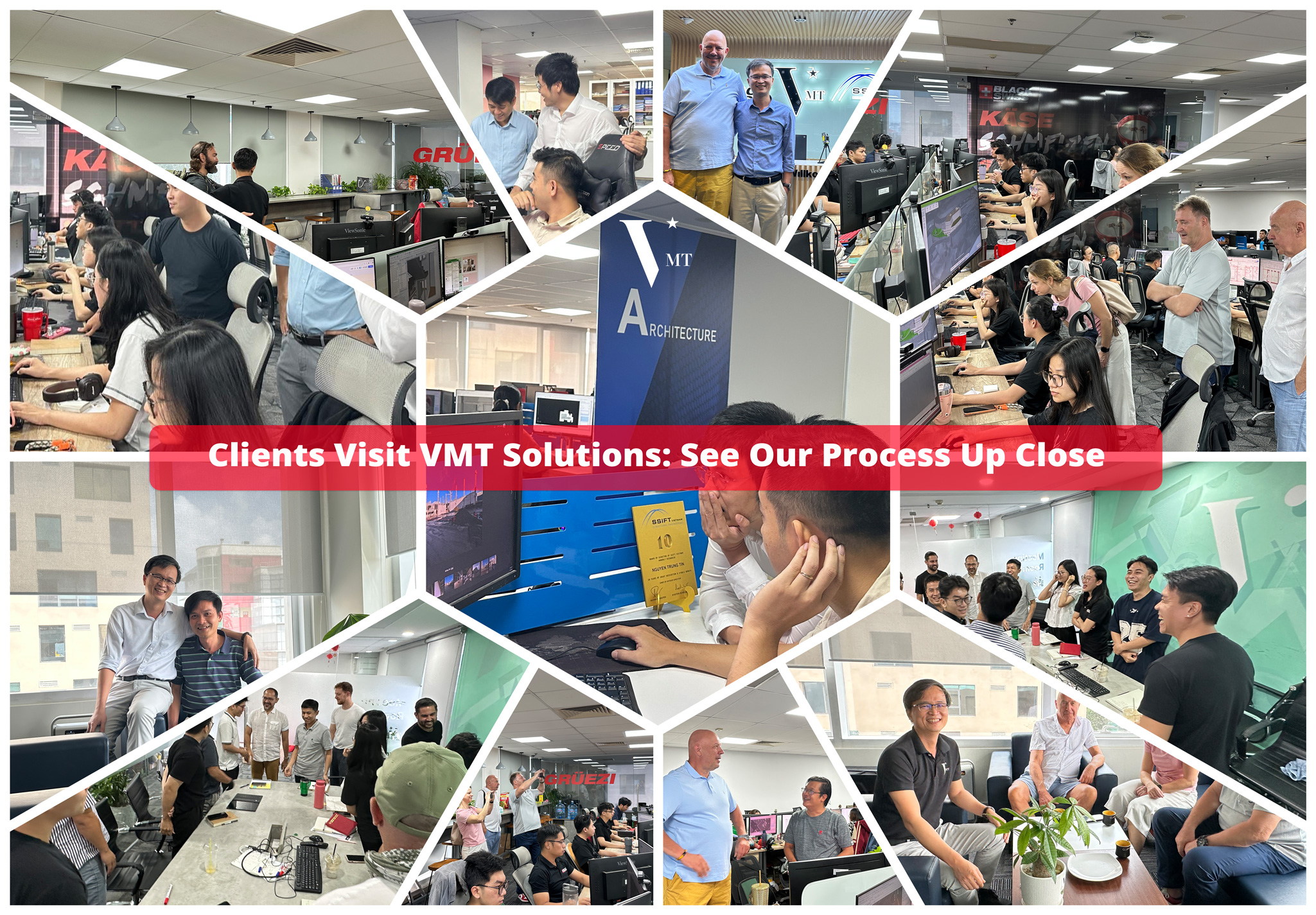
In the era of comprehensive digital transformation in the construction industry, VMT Solutions is proud to be a pioneer in providing high-quality, accurate, and on-time BIM modeling services from Point Cloud data. We have a team of highly qualified technicians, equipped with the latest technology and modern software systems, ensuring reliability and efficiency for our clients.
The advantages of partnering with VMT Solutions lie in our commitment to quality, precision, and quick turnaround times. We always listen and provide tailored solutions for each project—big or small—from design and construction to operation and maintenance.
Contact VMT Solutions today for a free consultation, accurate quotation, and to start your BIM modeling project from Point Cloud data. Visit our website vmts.ch or call our hotline for more information, and begin your digital transformation journey for your project easily and effectively.
Nguyen Huynh (Rainer)
")
About the Author:
Nguyen Huynh (Rainer) is Managing Director at VMT Solutions, specializing in Point Cloud to BIM workflows for surveying, planning, and engineering offices. He focuses on precise BIM models, clearly defined quality standards, and long-term technical partnerships.
Related Posts


Recent Posts


Tag Cloud


We are proud to have
satisfied customers.
 Gerd Gindullis, Lecturer for digital as-built data capture at Aachen University of Applied Sciences, TerraMeta 3D Laser Service
 Stefan Schramm, Architekt Stefan Schramm
„Your plans are perfect; I’ve never seen anything like this before. These are drawings of the highest quality, I must say. I want to express my sincere thanks once again for your work.“
 Endre Szokolai, Digitalplan-Szokolai
VMT modeled a large industrial building in 3D for our research project. We provided DWG plans to VMT, and they delivered a highly detailed model, including the building envelope, interior walls, openings, and stairs. We had previously contracted a German company for the same object, but unfortunately, it didn’t work out. I was relieved and pleased that VMT handled it so reliably. Thank you for the excellent work and the truly fair price!

Very reliable company, courteous staff, and top-quality work. Our plans were created quickly and accurately. Thank you for that. Highly recommended.

Excellent advice and high 3D modeling quality at a great price-performance ratio… What more could you want? I can highly recommend them…