Our recommendation for exporting point cloud files
Exporting point cloud files: Simply register and send the file to us
To optimize our workflow, we expect point clouds to remain as original as possible. Terrestrial scanners offer several advantages over mobile scanners, including higher accuracy and panoramic images that provide greater detail for drawing.
Therefore, whenever possible, we require registered point clouds as individual scan stations in E57 format—without cleanup, cropping, or processing. Simply register and send the file to us.
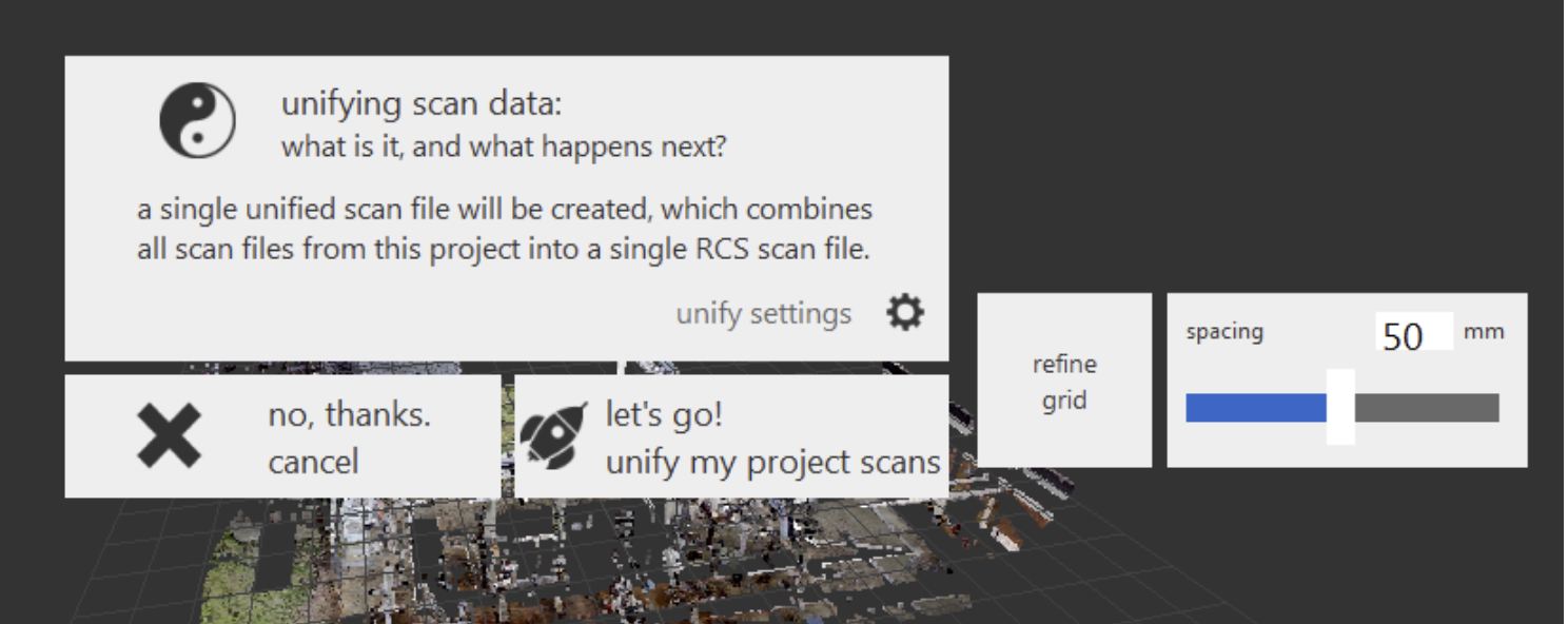
Since registration errors can occasionally occur, it is essential for us to receive point clouds as separate files—neither unified nor cleaned. This allows us to correct any errors ourselves. We do not recommend exporting as a unified E57 (Unified), as it results in the loss of structure and Bubble View functionality.
Exporting point clouds
Our recommendation applies only if you have the original files and can export the correct files to us.
If you are unable to export in a different format, please send us the format available to you—we will do our best to work with it.
We require point clouds after the registration process as individual scan stations, not unified, without cleanup, and exported directly in E57 format, as shown in our screenshots.
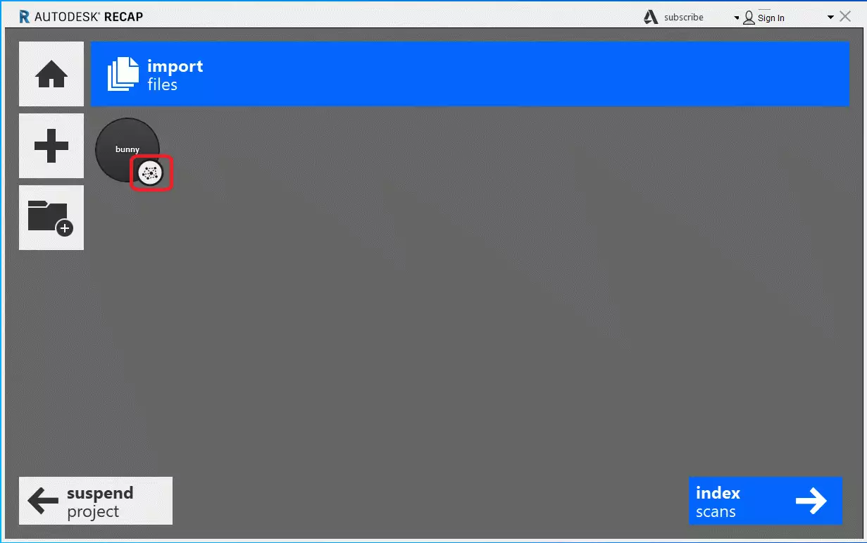
We can use Autodesk ReCap directly, but it is important for us that the files include panoramas (RealView or Bubble Views), no cleanup, no unification, and are exported as a ReCap Structured Project so that the scanner symbol is visible at each station (.RCP).
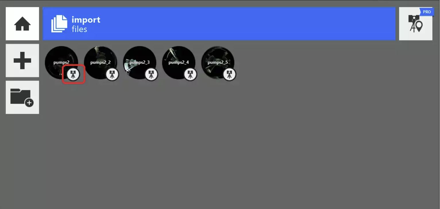
An unstructured project displays a spiderweb symbol.
Please make sure never to use the “Unified export into a single RCS” function, as this merges all stations into one. This makes it impossible to edit the registration later if the point cloud contains errors, and the panorama views are completely lost.
Export of a structured .e57 using the “Export” tool.
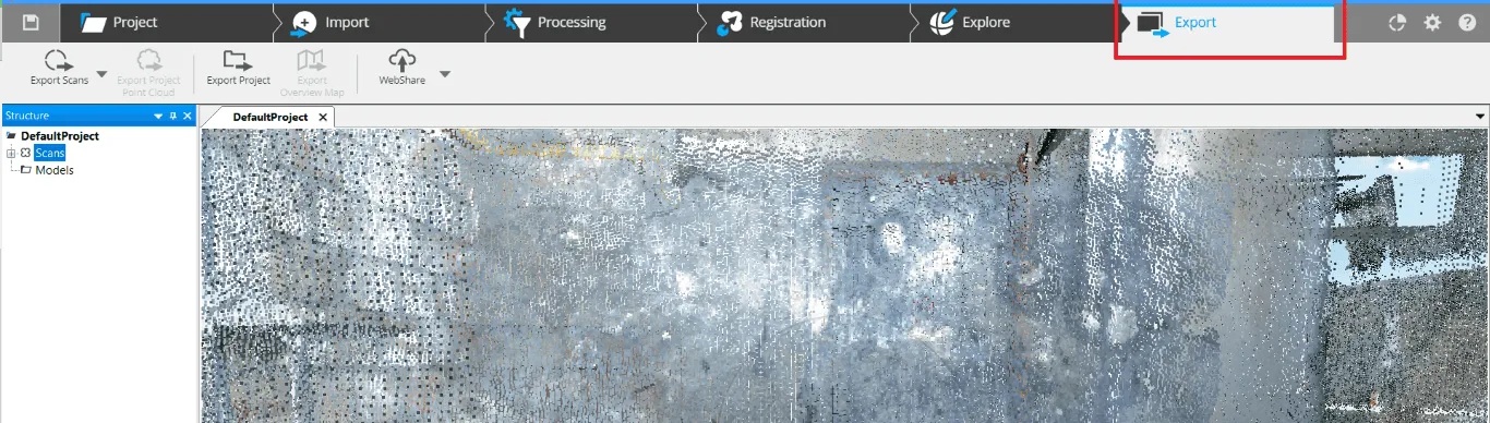
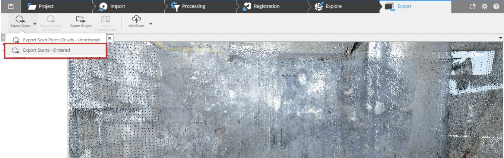
Exporting Faro point cloud files
Click on “Export Scans” in the top left of the window, then select “Export Scans – Ordered.”
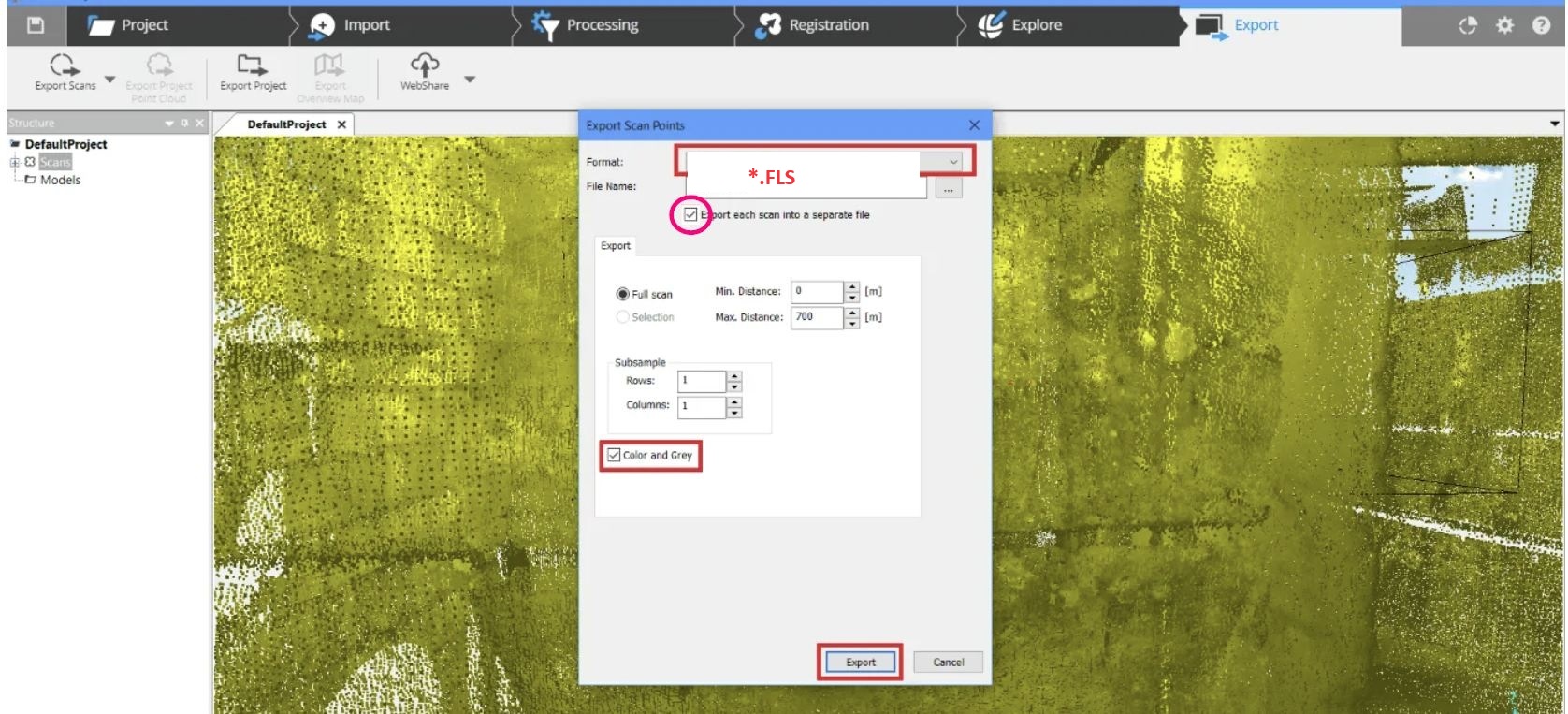
A new window will open. In this window, select the format (E57 in this case) and enter a file name.
Check the box for “Export each scan into a separate file.”
Optionally, you can enable the “Color and Grey” option to export the colors as well.
Then click “Export.”
Exporting a structured .E57 with Cyclone Register 360
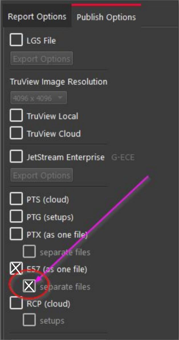
Once the processing and registration are complete, open the “Report” via the icon in the toolbar at the top right of the window.
After configuring the export settings, check the box for “E57 (separate file).”
A new window will open, allowing you to select the destination for the export.
RealWorks allows data export in the following formats: .E57, .PTX, .PTS, and .RCP.
We recommend the .E57 format, but other formats are also compatible with our workflow.
When you export your data from RealWorks as .E57, you will receive multiple separate .E57 files (one .E57 per station). This is optimal for our workflow.
Multiple .E57 files (one per station) can streamline the data transfer process to us.
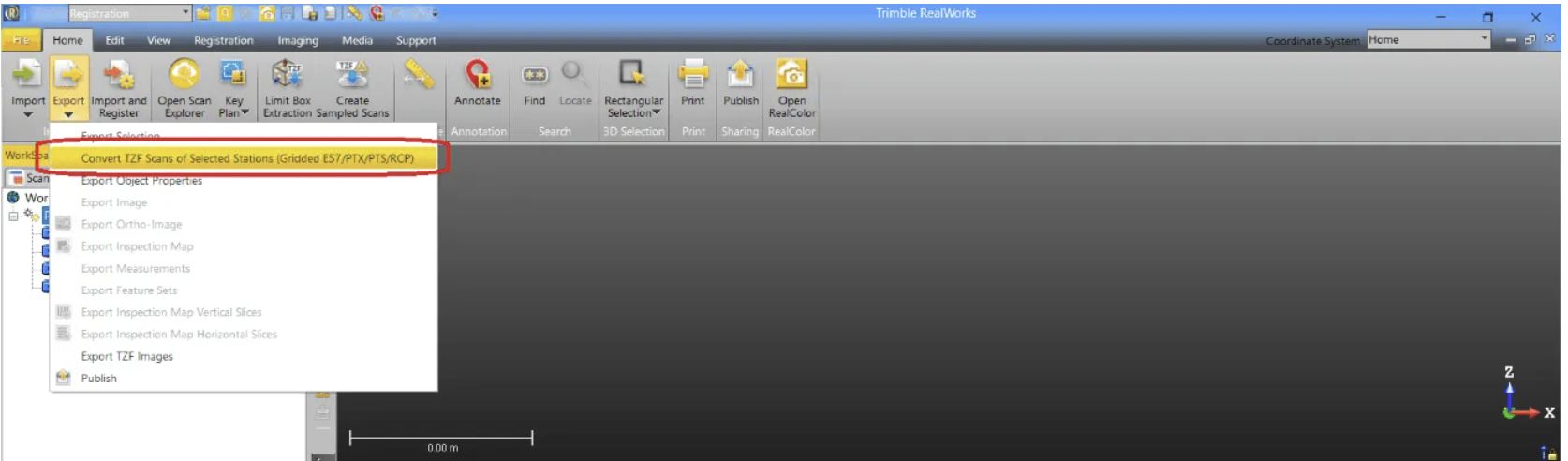
Once you have completed the registration:
- Select the project.
- Click on “Export” using the icon in the top left toolbar.
- Click on “Convert TZF scans of selected stations (Gridded E57 / PTX / PTS / RCP).”
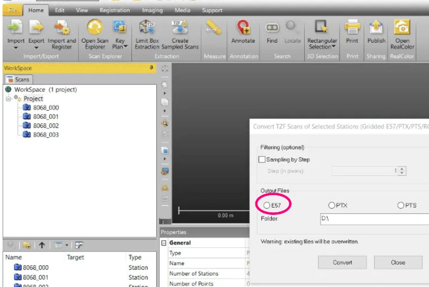
A new window will open.
- Select the desired export format – in this case, .E57.
- Define the destination for the export.
- Click “Convert” to start the process.
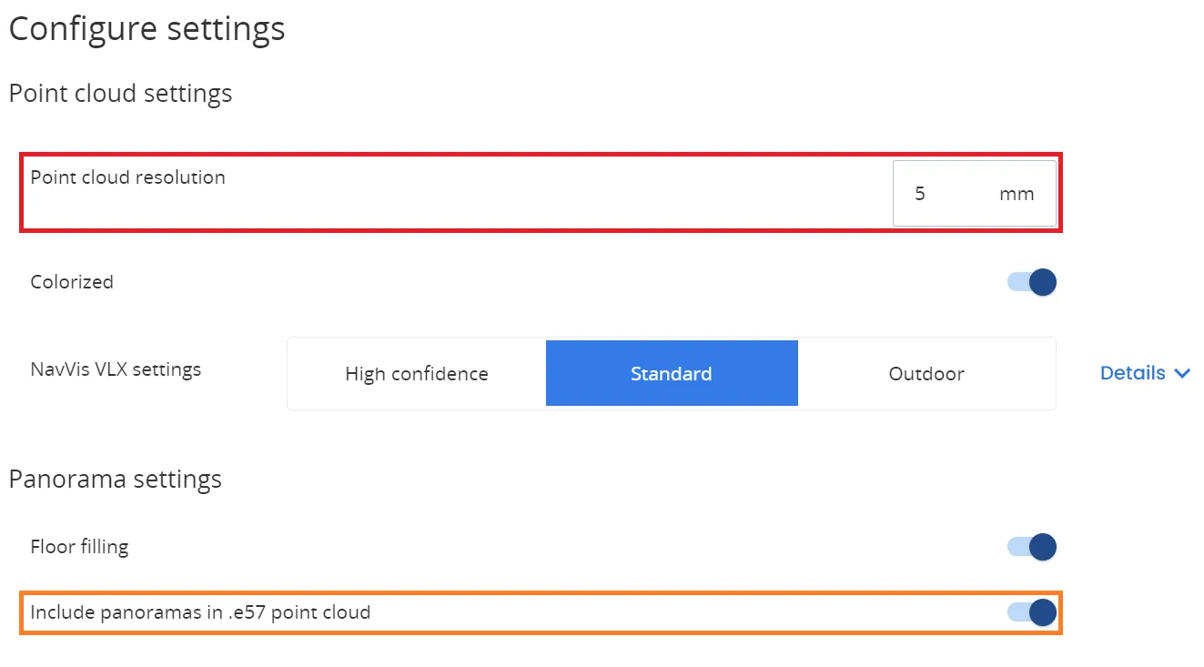
Open NavVis IVION and load the project:
- Open NavVis IVION and load your project.
- In the settings, set the point cloud resolution to a maximum of 5 mm.
- Enable the option “Include panoramas in .e57 point cloud.”
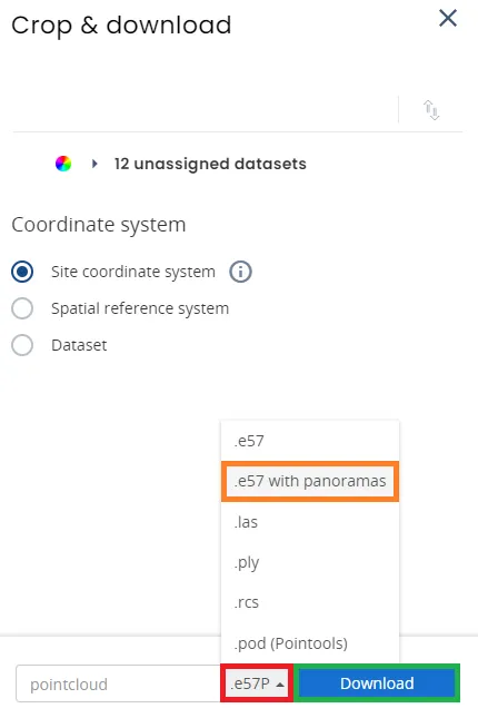
Downloading the .e57 file
Once the data has been processed and aligned:
- Navigate to Data Processing > Processed Data.
- Select the datasets for download.
- Ensure the correct export format, “.e57 with panoramas,” is selected.
- Click Download.
Optimal tips
Sending point cloud data
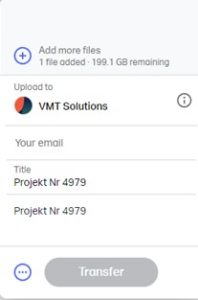
If you use our WeTransfer link https://vmts.wetransfer.com/ (this is our account), you can send up to 200GB at once. You can also increase the upload speed by using multiple browsers in parallel.
Once the upload is complete, our production team can immediately receive and download the data.
It would be perfect if you could include our project number 4979 in the title or message, so our team can immediately identify and properly assign it.
Important note:
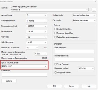
Point cloud data in E57 format can be efficiently compressed using ZIP or RAR. This can increase the compression rate by more than 50%. By compressing the data before uploading, you save time during the upload process and enable us to download the files more quickly.
Sending point clouds: Compression and efficient file upload/download
For all point cloud formats, it is essential to use compression (RAR, ZIP, or 7z) to significantly reduce the file size. This will greatly speed up both the upload and download process.
However, compression is not the only important factor—an efficient distribution method also plays a key role. Just like with screenshots, the files should be logically split to ensure an efficient transfer.

Why is compression and splitting important?
If we upload 100 TB as a single file, the upload will take around 2 days, as only one session is used. However, if an error occurs, the entire process is interrupted, and the upload must start over from scratch.
By compressing and splitting the files into smaller parts, the total size can be reduced by up to 60%. Additionally, this allows us to upload multiple files simultaneously—such as through 10 active FTP sessions at once—making the upload up to 10 times faster.
Even with WeTransfer, the transfer becomes much faster, and errors are minimized.
Alternative: Free software like 7-Zip can be used for efficient compression.